Tag Archives for " Aviation "
Appareo Acquires Aerovie

Planned enhancements to Aerovie will result in the industry’s most advanced electronic flight bag
FARGO, North Dakota (June 18, 2019) — Appareo today announced the acquisition of Aerovie, LLC, developer of the Aerovie electronic flight bag (EFB) suite that includes AHRS and synthetic vision, VFR sectional, IFR low/high, and geo-referenced approach charts.
Since introducing the first Stratus portable ADS-B receiver in 2012, Appareo has become the industry leader in the design and production of ADS-B equipment for general aviation. While the company has continued expanding on the hardware features and capabilities of Stratus receivers and transponders, it has been reliant on third-party flight apps to interface with the information provided by Stratus receivers. The first three generations of Stratus receivers (Stratus 1, Stratus 2, and Stratus 1S/2S/2i) were integrated with ForeFlight Mobile. The latest model, Stratus 3, was designed with “Open ADS-B Mode,” which means it integrates with any EFB app using GDL 90 protocol.
With the introduction of Stratus 3 last year, the engineers at Appareo began working with many EFB developers to ensure close integration with the newest model. Aerovie was one of the first companies to support Stratus 3 in its app.
“We were very impressed with the Aerovie team as we worked on the integration, and pleased with how smoothly it went,” said Appareo Aviation President Kris Garberg. “I started flying with the Aerovie app and Stratus 3 last year, and I was so impressed with the features and user experience that it became my ‘go to’ EFB.”
Garberg’s experience flying with Aerovie was the catalyst for Appareo to move toward this acquisition. Knowing that Aerovie was already performing well with Stratus 3, Appareo decided it was time to offer pilots a complete solution of tightly integrated hardware and software.
“All of us at Appareo Aviation are excited to work with Bryan Heitman and the Aerovie team to incorporate their exceptional EFB into the Appareo family, and offer a complete hardware and software solution. We plan to build on the success of Aerovie by adding many new features that will increase safety in the cockpit.” – Kris Garberg – President, Appareo Aviation
Some of the first additions to the Aerovie EFB will be features that Appareo developed for its own app, Stratus Horizon Pro. Introduced last year, Stratus Horizon Pro offers pilots helpful tools including backup AHRS, and Radio Playback, which captures Air Traffic Control (ATC) communications and saves them for easy one-touch playback. Additionally, there’s a beta feature called Radio Transcription, which converts ATC communications into text that’s displayed directly above the audio playback line.
“The product development team at Appareo Aviation has spent a considerable amount of effort developing speech recognition technology customized for aviation, and we’re excited to embed that cutting-edge technology throughout the Aerovie app,” Garberg said. “Our product roadmap is focused on creating a safer, more convenient way to fly. It centers around a beyond-glass strategy, which is the future of aviation.”
Bryan Heitman, the founder of Aerovie is a software developer, private pilot, and self-proclaimed weather geek. As the EFB market was getting started, Heitman considered how he could utilize his skills to create something valuable for pilots. When Lockheed Martin Flight Services announced in 2014 they would provide PIREPS into the national air system, Heitman saw an opportunity. He developed AerovieReports, the first app to deliver free PIREPS. AerovieReports grew a following, and Heitman began adding features. “As a pilot, I was using some of the popular flight apps, but there were gaps in their features. I decided to expand Aerovie to become a flight bag that provided everything I needed,” Heitman said.
Since then, Aerovie has evolved into a full-featured cockpit tool designed to make pilots’ lives easier and provide enhanced situational awareness. Aerovie is a leader for preflight weather planning, with tools designed to give pilots a deeper understanding of weather. For example, weather modeling products such as radar forecast, and a vertical weather profile tool that allows pilots to see conditions across their route of flight based on their aircraft speed and departure time.
“Being as committed as we were to providing robust and reliable weather tools, Stratus was definitely on our radar,” Heitman said. “We saw Appareo leading the ADS-B market with the best quality receiver available, but our customers couldn’t experience it until Stratus 3 was introduced.”
With the Aerovie acquisition comes good news for pilots who own older models of Stratus receivers. The first enhancement planned for the Aerovie app is support for Stratus 2, 1S, 2S, and 2i.
“We’re very excited to take Aerovie to the next level by joining the Stratus product family. Our companies have been aligned in our commitment to G.A. over the years. We understand the unique needs of a single-pilot operation versus a crew, and we’re committed to making flying safer and more friendly for that G.A. pilot,” – Bryan Heitman – Founder, Aerovie
Aerovie currently offers two subscription plans — $6.99 monthly or $69.99 annually. Current Aerovie app users will not experience a disruption in their service during the acquisition by Appareo. Once additional features are added to the app, current and new subscribers will be able to select from various plan levels. Those subscription options, as well as the app naming and branding, will be announced at a later date.
The terms of the acquisition are not being disclosed as both companies are privately held. For more information about Appareo Aviation, visit www.appareoaviation.com, and for Aerovie visit www.aerovie.com.
The Aerovie app is available on the App Store for iOS devices.
# # #
https://www.appareo.com/2019/06/18/appareo-acquires-aerovie/
New Features for FltPlan.com Safety Management System and FltLogic Scheduling Program
We’ve added several new features within the FltPlan.com Safety Management System (SMS) and FltLogic flight scheduling program. FltPlan.com has partnered with the Air Charter Safety Foundation (ACSF) to enable FltSafety.com SMS subscribers who are ACSF members, to voluntarily file Aviation Safety Action Program (ASAP) reports with the FAA. This integration further facilitates a proactive approach to self-reporting, while also identifying areas within a flight department where operational improvement is needed. Additionally, several new enhancements have been made to the FltLogic flight scheduling program that streamlines the user interface and allow users to see more information at-a-glance.
Flight departments can easily identify, track and mitigate risks using
FltPlan.com’s Safety Management System and ACSF ASAP participants can now
utilize it to submit ASAP reports to the FAA. The FAA’s Aviation Safety Action
Program focuses on the voluntary reporting of issues related to noncompliance
and/or safety. The voluntary nature of this initiative encourages compliance
with FAA regulations, while also fostering safe operating practices and
promoting the development of proper internal evaluation programs that have a
long-term impact on the safety of an operator and their organization.
Pilots can take advantage of the latest version of the Safety
Management System via the FltSafety.com website. Participation in the ASAP
program through FltSafety.com requires advanced registration with the Air
Charter Safety Foundation.
Several new features have also been added to FltLogic, a
comprehensive flight scheduling program that can be utilized within flight
departments starting at the initial trip request phase through post flight analysis.
These new features include:
- A new
single-page edit design allows users to more easily modify trip details. - Users
can create a private event within FltLogic, which hides all trip information
except the tail number of the aircraft. - Pilots
and schedulers can more easily track canceled and completed trips within FltLogic,
which now incorporates a canceled and completed trip box. - An
authorized pilot view gives pilots certain permissions within FltLogic to view
scheduled events for any aircraft the pilot is authorized to fly. - Calendar
colors can now be customized to indicate specific events such as maintenance or
training, so it’s easier to identify aircraft reservation information.
These new features within FltPlan.com and FltLogic are available immediately. For additional information, visit: www.FltPlan.com and www.FltLogic.com.
The post New Features for FltPlan.com Safety Management System and FltLogic Scheduling Program appeared first on Garmin Blog.
https://www.garmin.com/en-US/blog/aviation/new-features-for-fltplan-com-safety-management-system-and-fltlogic-scheduling-program/
Latest FIS-B Weather Products and More Added to GTN 650/750 Series
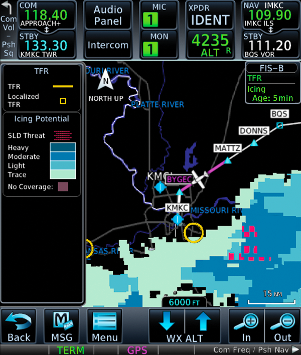
We have incorporated new enhancements and features to our GTN 650/750 series touchscreen navigators. With the latest software update and a compatible ADS-B In receiver, pilots can now view new FIS-B weather products on the GTN. Also, when the GTN 650/750 is paired with a G3X Touch flight display in experimental/amateur-built aircraft, pilots now have the option to edit VFR flight plan information from the G3X Touch. These features and more are available immediately from Garmin Authorized Dealers for hundreds of aircraft makes and models.
New
FIS-B weather product support
When paired with a compatible ADS-B In product such as the
GTX 345 or GDL 88, pilots can now access the latest FIS-B weather products on
the moving map alongside flight plan information and dedicated weather pages
within GTN 650/750. These new weather products include lightning, cloud tops,
turbulence, icing (current and forecasted), graphical AIRMETs and center
weather advisories (CWA). This adds to the growing number of Garmin products
that already support these new weather products, including Garmin Pilot on
Apple mobile devices, G3X Touch and the aera 660 aviation portable.
G3X
Touch flight plan editing
Pilots who have a GTN 650/750 installed alongside a G3X
Touch flight display in an experimental/amateur-built
aircraft now have additional flight planning and editing options. VFR flight
plans can now be completed on the G3X Touch display, and then automatically
synced to the GTN for added convenience when using either the G3X Touch or GTN.
Additional
features
- The
GTN 650/750 now displays a selected altitude intercept arc on the moving map
when it’s installed with a Garmin primary flight display (PFD) such as the G500
TXi/G600 TXi, G500/G600 or G3X Touch. When pilots input a preselected
altitude on the PFD, the selected altitude arc will populate on the map page to
indicate where the aircraft will arrive at that particular altitude. - For
customers with SiriusXM Aviation Weather, pilots now have the option to alternate
between base reflectivity and composite reflectivity NEXRAD weather radar
imagery. - Pilots
operating into airports throughout the world that are not served by SBAS, can
now receive advisory vertical guidance (LNAV+V) while flying LNAV approaches
with the GTN 650/750. - When
SiriusXM aviation weather or FIS-B weather cannot be displayed on the GTN
650/750, the “no coverage” area of weather is transparent so pilots can still
view airports, basemap information and more. - Customers
receive a VNAV aural alert for Top of Descent (TOD). - Traffic
and weather from a GNX 375 can now be displayed within the GTN 650/750.
The latest GTN software upgrade is available immediately from Garmin Authorized Dealers for hundreds of aircraft makes and models. This upgrade is available at no charge. A dealer installation charge may apply. Garmin avionics are supported by our award-winning aviation support team, which provides 24/7 worldwide technical and warranty support.
The post Latest FIS-B Weather Products and More Added to GTN 650/750 Series appeared first on Garmin Blog.
https://www.garmin.com/en-US/blog/aviation/latest-fis-b-weather-products-and-more-added-to-gtn-650-750-series/
Garmin OnePak: All Your Database Needs, One Simple Solution
It’s finally complete. Your perfect airplane now has the
perfect panel. Those dual Garmin GPS navigators and flight displays you’ve
always wanted are installed, plus an aera series portable navigator to help
with flight planning and added cockpit situational awareness. These products
feature sophisticated data ranging from navigation data, charts, airport
diagrams, obstacles, terrain and more. For those flying IFR regularly, the FAA
requires a product’s navigation data to be updated every 28 days. For SafeTaxi,
obstacles and terrain databases, updates are available every 56 days. We’ve
created annual subscription packages for the US and Canada — known as OnePaks —
to more conveniently and affordably satisfy a single aircraft’s entire database
needs.
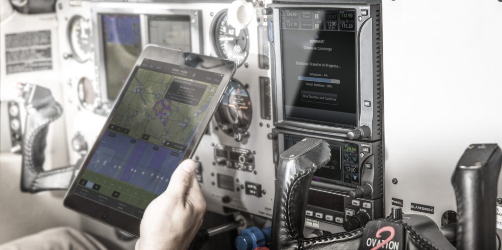
One aircraft. One
database package. One cost-effective price.
Our OnePak annual subscriptions offer significant savings for
an aircraft equipped with multiple Garmin products. For one annual price,
databases within OnePak subscriptions can be downloaded to multiple Garmin
avionics and one qualifying portable in a single aircraft. These databases
include the Garmin Navigation Database, AOPA Airport Directory, IFR enroute
charts, VFR sectional charts, Obstacles, SafeTaxi, Terrain and Basemap for
compatible products. OnePaks are compatible with the following flight decks,
flight displays, avionics, and portables:
- GTN 650/750 touchscreen navigators
- GNX 375/GPS 175 touchscreen navigators
- GNS 430/530 navigators
- G500/G600/G500H and TXi series glass flight
displays - G1000 NXi, G1000, G2000, G3000 and
G5000 integrated flight decks - G3X, G3X Touch and G900X glass flight
displays - aera 500/660/795/796 GPS portables
- GPSMAP 696/695 GPS portables
OnePak database subscriptions start at $649 and include a
Garmin Pilot Premium upgrade.
Wireless updates with
Database Concierge
Additionally, for aircraft with GTN 650/750 and GNX 375/GPS
175 series touchscreen navigators or select aircraft equipped with G1000 NXi,
our Flight Stream 510 can offer another level of convenience for updating
databases. Flight Stream 510 is a small, patented multimedia card enabled with
Wi-Fi and BLUETOOTH technology that enables communication between GTN 650/750 and
GNX 375/GPS 175 series navigators or G1000 NXi, and two compatible Apple or
Android mobile devices operating Garmin Pilot. Operators can simply download
new databases via Garmin Pilot on a mobile device, then wirelessly upload them
directly to the GTN 650/750, GNX 375/GPS 175 or G1000 NXi in the cockpit.
For more information about our OnePak database solutions, and to find out which best suits your needs, visit flygarmin.com.
The post Garmin OnePak: All Your Database Needs, One Simple Solution appeared first on Garmin Blog.
https://www.garmin.com/en-US/blog/aviation/garmin-onepak-all-your-database-needs-one-simple-solution/
New Upgrades for G1000 NXi-Equipped King Air Aircraft
We are pleased to announce new features and upgrades available for the G1000 NXi integrated flight deck in the King Air 200/250/300/350 series aircraft.
A new, Bluetooth-enabled
audio panel for the G1000 NXi integrated flight deck in the King Air offers an
expanded feature set alongside innovative sound quality. Home theater-like
music effects add to the rich audio characteristics provided by the audio panel,
allowing pilots to select bass boost levels, as well as equalizer effects,
including rock, classical and pop. Advanced auto squelch automatically adapts
to the noise level within the cockpit and allows for natural conversation
through headsets. It includes a six-place stereo intercom and support for up to
three stereo music inputs. Split-COMM mode allows the pilot and co-pilot to
broadcast independently on two separate frequencies and contains dedicated
pilot and co-pilot music and intercom volume control knobs. Additionally, a
built-in digital clearance recorder can record up to 60 seconds of selected
COMM radio transmissions so pilots can easily play back difficult clearances.
The first to introduce 3D Audio, we have incorporated 3D audio processing into the audio panel. With stereo headsets, incoming audio is spatially separated to reflect how people naturally process sound and conversation by differentiating audio sources by their unique locations or seat position. For example, sound from COMM 1 will come from the left, whereas sound from COMM 2 will sound as though it’s coming from the right. Using stereo headsets, listen to a demonstration of 3D Audio here: http://www.garmin.com/us/explore/intheair/how-does-3d-audio-work/
As a standard feature of the audio
panel, pilots can connect a smartphone or tablet via Bluetooth to easily make
or receive phone calls, stream audio entertainment or wirelessly connect to
select Garmin HD action cameras. Offering a seamless upgrade path, pilots and
aircraft owners can easily upgrade (or select as an option with a new G1000 NXi
installation) to the new audio panel as its slide-in replaceable and only
requires minor wiring modifications.
The GWX 75 weather radar is
also compatible with the latest upgrade for G1000 NXi-equipped King Air
aircraft, which offers exceptional range and a new, enhanced color palette that
features four-times more color contouring than traditional weather radars on
the market. The Doppler-based, solid-state GWX 75 offers a range of 320
nautical miles, horizontal scan angles of up to 120 degrees and to focus on an
area of interest, pilot-adjustable sector scanning. The GWX 75 also retains vertical
scan capabilities, which allows the pilot to focus on storm tops, gradients and
storm cell build-up at various altitudes. Optional features such as
Doppler-enabled turbulence detection and ground clutter suppression are also
available with the GWX 75.
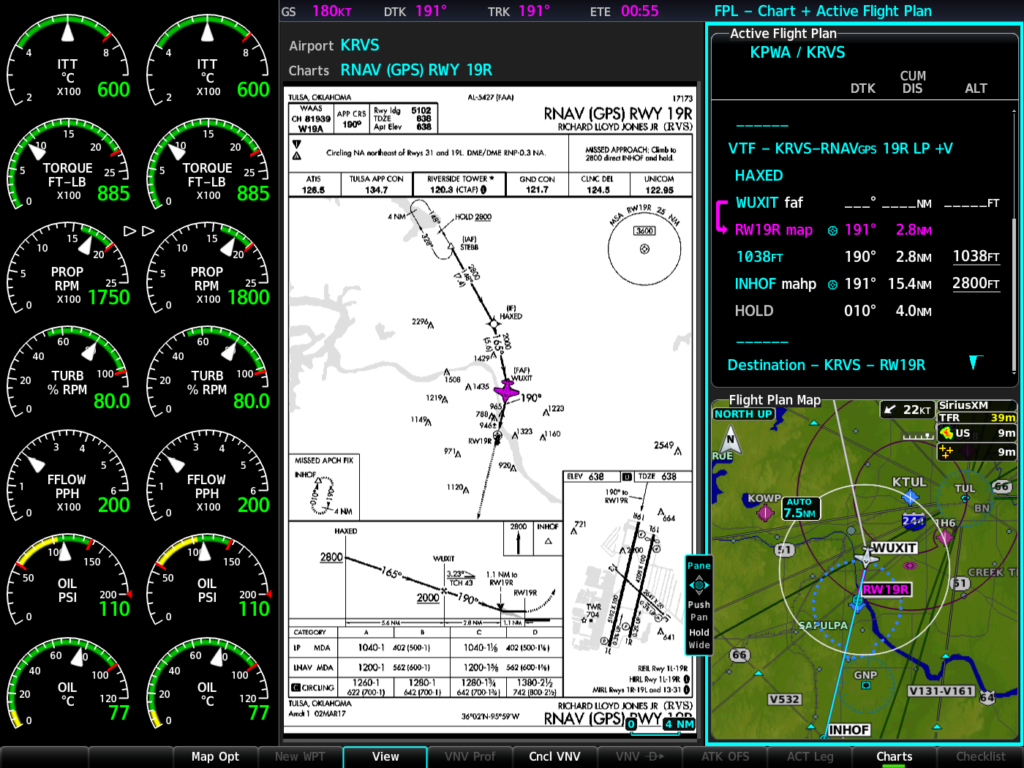
Also included as part of this
upgrade:
- Split-screen view is available on the MFD,
offering a simultaneous view of maps, charts, checklists, flight plans and more
on a single screen. - Pilots can view decoded Terminal Aerodrome
Forecasts (TAF’s) on the primary flight display (PFD) and multi-function
displays (MFD).
For current King Air
owners and operators, the latest features are available immediately from select
Garmin Authorized Dealers as a free upgrade (installation and hardware charges
may apply). Optional equipment upgrades are also currently available. King Air
owners and operators may contact a Garmin Authorized Dealer for pricing
information. For more details regarding the G1000 upgrade for the King Air
series aircraft, contact Scott Frye at (913)-440-2412. For additional
information, visit: www.garmin.com/kingair.
The post New Upgrades for G1000 NXi-Equipped King Air Aircraft appeared first on Garmin Blog.
https://www.garmin.com/en-US/blog/aviation/new-upgrades-for-g1000-nxi-equipped-king-air-aircraft/
Appareo Brings AI and FDM Expertise to Panel Discussions at EBACE
Appareo’s Director of AI Systems Josh Gelinske and Vice President of Solutions Brad Thurow are scheduled to participate in two panel discussions during the European Business Aviation Convention & Exhibition (EBACE) in Geneva on May 22, 2019.
View the full agenda here: EBACE Program Schedule

‘Lexi, book me a jet’: Artificial Intelligence and Business Aviation
Moderator: Eric Leopold, International Air Transport Association (IATA)
Panelists:
Josh Gelinske, Appareo
Peter Conrardv, GE Aviation
Bernhard Fragner, CEO & Founder, GlobeAir
Shiv Trisal, Aftermarket Digital Strategy Lead, Collins Aerospace
Description from EBACE website:
While companies like Facebook, Apple and Amazon rollout revolutionary changes to how we interact with machine-learning technology, many are still uncertain on exactly how artificial intelligence (AI) is being used by aerospace businesses. As an industry, business aviation is constantly striving to improve both the way it works and its customer satisfaction. To that end, it embraces technological advancements by constantly adapting to society’s needs. But AI can potentially go far beyond its current uses. Quite simply, AI can redefine how our industry goes about its work. In this session we will share insights by industry representatives on the improvements AI contributes to the aviation sector. We invite you to join us for this exciting panel discussion.

FDM – What Do You Need?
Moderator: Johan Glantz, EBAA
Panelists:
Dave Jesse, FDS
Kevin Martin, Aerobytes
Brad Thurow, Appareo
Description from EBACE website:
Whether you were already considering a Flight Data Monitoring (FDM) solution or plan on an acquiring an aircraft already fitted with one, this session aims at discussing the financial and operational impact, as well as the implications it has on your aircraft’s cockpit and on-ground hardware.
EBACE | May 21-23, 2019 | Geneva, Switzerland
EBACE is a premier event and the annual meeting place for the European business aviation community. The exhibition is jointly hosted each year by the European Business Aviation Association (EBAA), the leading association for business aviation in Europe, and the National Business Aviation Association (NBAA), the leading voice for the business aviation industry in the United States. Although EBACE is the only major European event focused solely on business aviation, attendees come from as far as Africa, Asia, the Middle East and North and South America.
https://www.appareo.com/2019/04/26/appareo-brings-ai-and-fdm-expertise-to-panel-discussions-at-ebace/
Terminal Safety Solutions: Extended Runway Centerlines
The more you know — an overused saying and even more overused internet meme. But it still holds a lot of truth. In an age where information is at an all-time high, thanks largely to advances in technology, we have the opportunity to know more and be more confident, especially in the cockpit. Sometimes what we consider to be the slightest details can have the greatest impacts. Take for example our extended runway centerlines feature available within Garmin Pilot, GTN 750/650 series navigators, G3X Touch and aera 660/796. It’s only a small part of these products’ overall capabilities, but it’s designed to help ensure pilots are aligned with the proper runway.
Why it’s important
The FAA has labeled wrong-surface events as one of their top priorities for aviation safety. What is a wrong-surface event? According to the FAA, it’s when an aircraft lands or departs, or tries to land or depart, on the wrong runway or on a taxiway. Or even if an aircraft tries to land or takeoff at the wrong airport! Airports are growing in size and complexity, often with a network of parallel runways, and taxiways that could be interpreted as runways.
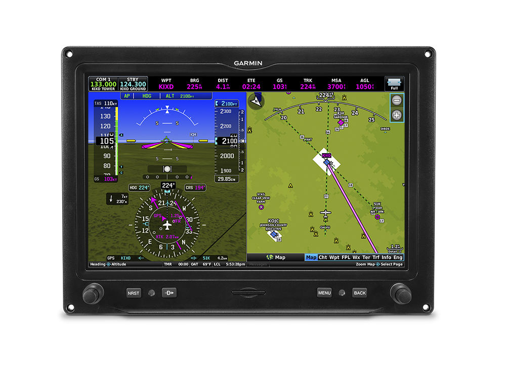
Our extended runway centerlines feature is as simple as it
sounds — it can automatically provide pilots with an extended view of the
runway’s approach path from miles away. When setting up for final, it’s a quick
and easy way to help ensure that you’re aligned with the proper runway.
Different styles for
different pilots
We’ve created several pilot-selectable options to help tailor
our extended runway centerlines to each pilot’s preferred style. The feature’s
zoom levels can range from 200 feet up to five nautical miles on the moving
map. And different display styles are available from a feathered arrow to dashed
lines and chevrons. If desired, the feature can be disabled easily within the product
settings.
In this case, the more
you know means added situational awareness and useful information in the
cockpit, even if it is as simple as a single feature within a pilot app. Get
added confidence that you’re lined up with the runway, or airport, you’re
intended for.
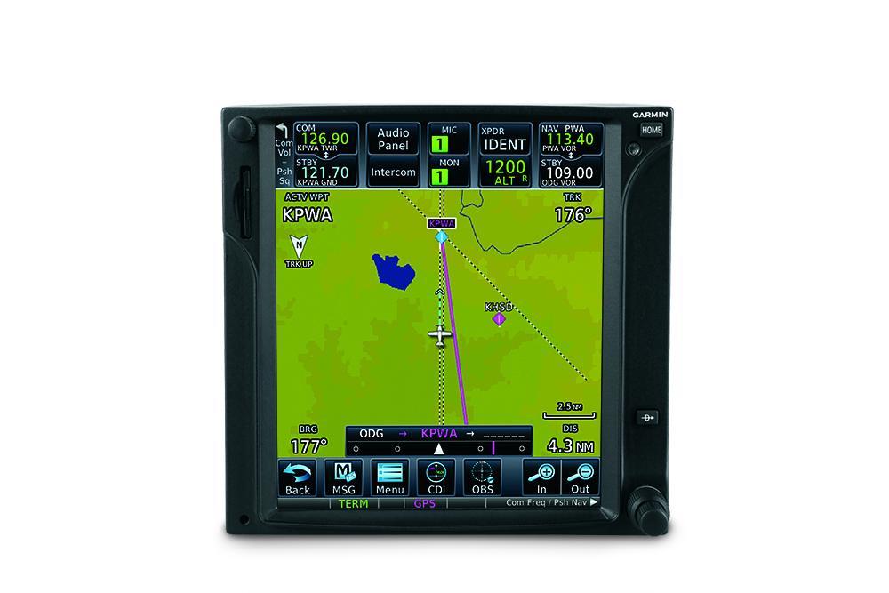
To learn more about Garmin Pilot and its features, visit our website. Also, be sure to check out our other Terminal Safety Solutions designed to enhance situation awareness in the airport environment, including SafeTaxi, SurfaceWatch and Visual Approach Guidance.
The post Terminal Safety Solutions: Extended Runway Centerlines appeared first on Garmin Blog.
https://www.garmin.com/en-US/blog/aviation/terminal-safety-solutions-extended-runway-centerlines/
Garmin Celebrates First Flight of G3000 in a Supersonic Tactical Aircraft
Tactical Air Support, Inc. (Tactical Air) has completed the maiden flight of a Garmin integrated flight deck in a supersonic F-5 fighter aircraft. In just under six months, Tactical Air completed the engineering design, installation and first flight with the G3000 integrated flight deck and dual Garmin touchscreen controllers (GTCs). The G3000 in the F-5 is expected to be ready to perform adversary training for the U.S. Navy in Q2 2019. This commercial-off-the-shelf (COTS) Garmin solution allows Tactical Air to take advantage of reduced development time, lower life-cycle costs and reduced operational costs, through highly reliable state-of-the-art designs.
“The maiden flight of the G3000-equipped F-5 is a significant
achievement as it is a testament to the rapid implementation time and
flexibility afforded by a Garmin integrated flight deck,” said Carl Wolf, vice
president of aviation sales and marketing. “In just under six months, Tactical
Air was able to complete the engineering design, installation and achieve first
flight. Through their hard work, dedication and our strong relationship
together, we’re thrilled that they’re already in the air with the Garmin G3000
in this iconic aircraft. I am confident that the Tactical Air pilots will enjoy
flying behind Garmin glass.”
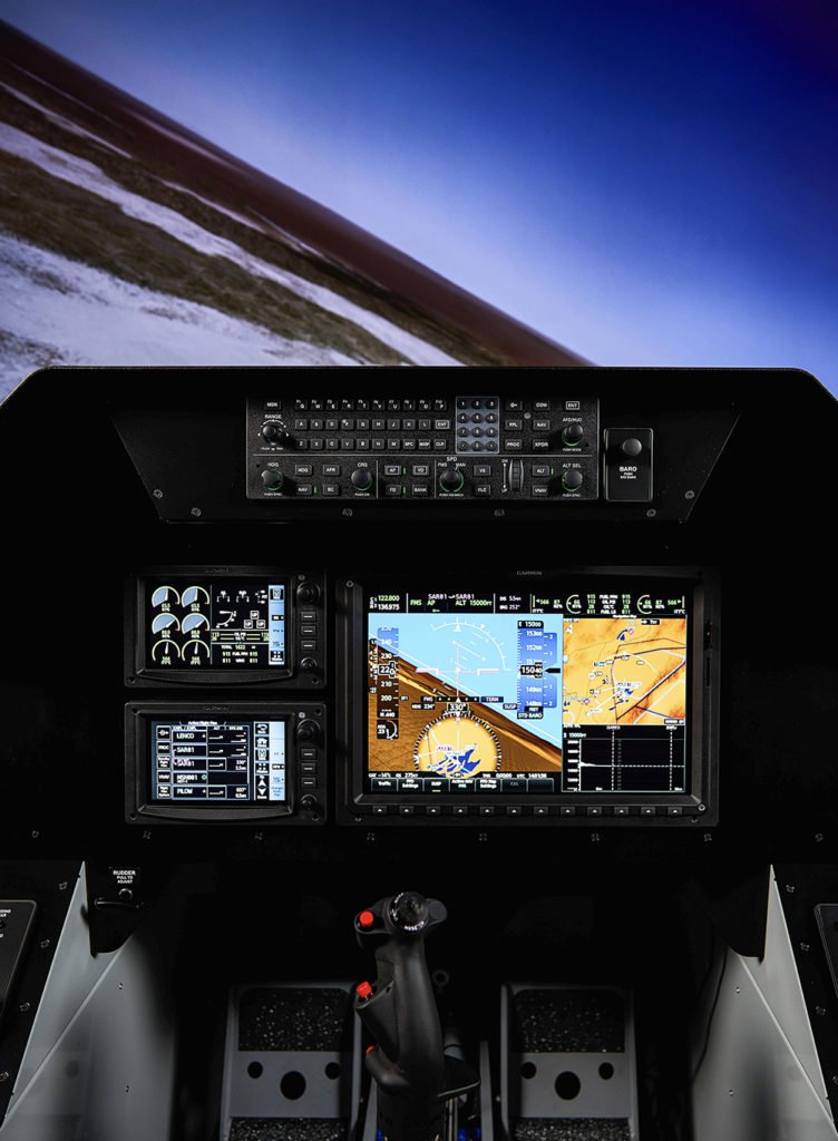
The F-5 is a
supersonic, multi-role tactical fighter and attack aircraft that in this role
will provide air-to-air combat training, close-air support training, tactics
development and evaluation support. The upgraded F-5 used by Tactical Air will be used in an aggressor
training role and the G3000 will transform the entire fleet of Tactical Air F-5’s
with sensor and system capabilities similar to current fighter aircraft.
“The first
flight of the F-5 was flawless and achieved the main objective of verifying
Pilot Vehicle Interface (PVI) of aircraft systems, displays, controls and the
new Caution/Advisory System (CAS). The PVI and CAS, when combined with the
G3000, results in a more capable fighter aircraft,” said Ken Hamm, Tactical Air
chief test pilot. “As
a career test pilot with over 7,000 flight hours, I have flown aircraft from
the simplest to the space shuttle. Without a doubt, I can say the F-5 cockpit
is one of the most capable and flexible of all.”
The modular
G3000 integrated flight deck boasts a large and vibrant, high-resolution flight
display that seamlessly interfaces to the F-5’s existing mission computer,
enabling advanced mapping, tactical radio capabilities, radar display and more.
The bezel keys, GTCs and L3 ForceX mission system serve as the pilot
interface to the flight display, and the touchscreen controllers are designed so
pilots can use gloves in the cockpit. The G3000 has an open architecture that
enables seamless mission computer, sensors and systems interface and easily
facilitates future upgrades without impacting the avionics.
The
NVG-compatible G3000 contains modern, state-of-the-art synthetic vision
technology (SVT ) that blends an out-the-window view of surroundings on the
primary flight display, which is particularly helpful during nighttime and in mountainous
environments. The G3000 also has global capabilities for communication,
navigation, surveillance and air traffic management (CNS/ATM). Additional
features within the G3000 integrated flight deck on the F-5 include, Terrain
Awareness and Warning System (TAWS), global Automatic Dependent
Surveillance-Broadcast (ADS-B) traffic and weather, as well as video interfaces.
Through its expansive
dealer network and award-winning aviation support team, Garmin is renowned for
its unrivaled global service network, offering complete life-cycle support.
Field service engineers are strategically located throughout the globe to
support any mission. Garmin also has a full range of training solutions,
including computer-based training, instructor-led training and full-motion
simulator compatibility. For additional information regarding Garmin’s defense,
commercial or business aviation solutions, visit www.garmin.com/aviation.
The post Garmin Celebrates First Flight of G3000 in a Supersonic Tactical Aircraft appeared first on Garmin Blog.
https://www.garmin.com/en-US/blog/aviation/garmin-celebrates-first-flight-of-g3000-in-a-supersonic-tactical-aircraft/
Garmin Demonstrates Datalink Weather Broadcast for Pilots in Germany
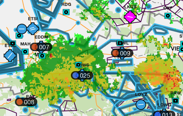
The Garmin aviation team has expanded the availability of datalink weather through a technology demonstration in Friedrichshafen, Germany (EDNY). Using a ground-based Universal Access Transceiver (UAT) that is comprised of Garmin hardware at the EDNY airport, weather information is broadcast and received by aircraft equipped with select Garmin ADS-B In products and displayed on Garmin avionics and portables. For appropriately equipped aircraft, there is no additional cost to receive weather information during this evaluation period, which is expected to end in Q4 of 2019.
“Based on the success of datalink weather in the United States, we are
excited to demonstrate affordable datalink weather in Germany and look forward
to evaluating the feasibility of this technology in Europe,” said Carl Wolf,
vice president of aviation sales and marketing. “We would like to extend our
appreciation to the German licensing agencies, as well as airplus maintenance for
hosting the station and embracing this technology as we collectively aim to
provide pilots with better tools that can aid and improve in-flight
decision-making.”
Today, pilots operating within the vicinity of the Friedrichshafen
airport with compatible ADS-B In receivers have access to new datalink weather
products in Europe. Weather products accessible through this ground station
include, radar imagery, METARs, TAFs, lightning, icing and winds aloft. Pilots
can expect to receive weather up to 50 nautical miles away from the ground
station located at EDNY and weather products will display within a 250 nautical
mile coverage area. Reception is also dependent upon line of sight. Through
this, Garmin aims to demonstrate the advantages of widely available datalink
weather for aircraft operators in Europe.
“AOPA Germany welcomes Garmin’s efforts in Europe. It is obvious that
safety in General Aviation should increase if pilots have access to weather
information in their cockpits. We know that it has been a significant effort to
work in cooperation with the authorities to make the frequencies available, and
Garmin has done a great job of explaining the safety case behind it and has
succeeded,” said Dr. Michael Erb, senior vice president, AOPA Europe. “We are
convinced that the results of the datalink weather demonstration will be
positive and that it can serve as a good justification for bringing in-flight
weather, as well as traffic and AIS information, into all GA cockpits in
Europe.”
Currently, the system architecture leverages the US-defined FIS-B datalink using UAT technology. Garmin has flight tested the reception of these weather products in a Cessna 182 equipped with a GTX 345 ADS-B transponder, GTN 650/750 navigators, G500 TXi flight display, aera 660/795/796 GPS portables, the GDL 50 portable ADS-B receiver and the Garmin Pilot app on Apple mobile devices. Garmin expects compatibility with additional UAT-based receivers and displays.
These datalink weather products are available immediately for pilots
operating in the vicinity of the Friedrichshafen airport in Germany. Pilots who
fly into AERO Friedrichshafen in Germany (April 10-13, 2019) and use the new
datalink weather products are encouraged to provide feedback at the Garmin
exhibit (Hall A6). Pilots can also submit feedback via this website: https://www.garmin.com/en-US/forms/UATfeedback/. Garmin is also hosting a press conference at AERO Friedrichshafen on
Thursday, April 11th at 16:00 local in Conference Center West,
Room Schweiz. For additional information regarding Garmin datalink products,
visit www.garmin.com/aviation.
The post Garmin Demonstrates Datalink Weather Broadcast for Pilots in Germany appeared first on Garmin Blog.
https://www.garmin.com/en-US/blog/aviation/garmin-demonstrates-datalink-weather-broadcast-for-pilots-in-germany/
Garmin TeamX Brings New FIS-B Weather Products to G3X Touch, aera 660 and aera 795/796
Our TeamX experimental avionics group introduced new Flight Information Service-Broadcast (FIS-B) weather capabilities to several popular Garmin products. These capabilities are available through the Automatic Dependent Surveillance-Broadcast) ADS-B ground station network in the United States. Pilots can now access this new weather information on the G3X Touch flight display for experimental aircraft and the aera 660 and aera 795/796 portables using Garmin receivers that support ADS-B In.
The introduction of the new FIS-B weather products give pilots additional tools to better interpret the broader weather picture. These new products include lightning, turbulence, icing (current and forecast) and cloud tops. With at least one ADS-B ground station in view while in-flight or on the ground, pilots can easily access and receive beneficial weather in the cockpit within the U.S.
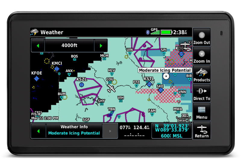
Garmin ADS-B products are currently capable of receiving these new
services. These products include the GTX 345, GDL 88, GDL 84, GDL 52,
GDL 50, GDL 39 3D and GDL 39. Compatibility is also extended to include all
remote-mount Garmin ADS-B In receivers. These ADS-B In receivers do not require
a software update in order to receive the new weather products.
In addition
to the G3X Touch for experimental aircraft, aera 660 and aera 795/796
compatibility today, the Garmin Pilot app on Apple mobile devices can also
receive and display these new FIS-B weather products.
To learn more about our latest products and features, visit our website at garmin.com/aviation and follow us on Facebook, Twitter and Instagram.
The post Garmin TeamX Brings New FIS-B Weather Products to G3X Touch, aera 660 and aera 795/796 appeared first on Garmin Blog.
https://www.garmin.com/en-US/blog/aviation/garmin-teamx-brings-new-fis-b-weather-products-to-g3x-touch-aera-660-and-aera-795-796/
