Tag Archives for " Aviation "
G1000 NXi Certified for Embraer Phenom 300
Embraer Phenom 300 business jets equipped with the Prodigy Flight Deck can now be upgraded to our powerful G1000 NXi integrated flight deck. The G1000 NXi boasts an array of modern features, including wireless connectivity, SurfaceWatch runway monitoring technology, visual approach guidance, HSI map and more. The displays also preserve the same mechanical footprint and harness connections so time to complete the G1000 NXi upgrade is minimized.
“Given the popularity and adoption rate of the G1000 NXi upgrade programs, we’re excited to grow this program to now include the Phenom 300,” said Carl Wolf, vice president of aviation sales and marketing. “Significant performance enhancements accompany exclusive features such as wireless flight plan transfer that result in time savings in the cockpit, making this upgrade essential for all Phenom 300 owners and operators.”
Connext® technology is available as standard on the G1000 NXi in the Phenom 300, which enables the wireless transfer of aviation databases from the Garmin Pilot app on a mobile device to the integrated flight deck. Additional wireless capabilities include two-way flight plan transfer, the sharing of GPS information, back-up attitude information and more, between the G1000 NXi and the Garmin Pilot, FltPlan Go and ForeFlight Mobile applications.
The GWX 75 Doppler weather radar is available as an option with the G1000 NXi in the Phenom 300 and incorporates exceptional range and a high-definition color palette that features four-times more color contouring than typically displayed by other weather radars on the market. Boasting a solid-state design, the GWX 75 offers reduced power consumption and extended life compared to earlier generation, magnetron-based weather radars.
The G1000 NXi integrated flight deck in the Phenom 300 also supports additional features, including:
- Pilots can overlay a moving map within the horizontal situation indicator (HSI).
- The addition of SurfaceWatch runway monitoring technology provides visual and aural cues to help prevent pilots from taking off or landing on a taxiway, on a runway that is too short or on the wrong runway.
- Visual approach guidance helps pilots fly a more stable descent and precise flight path throughout the approach and landing phases of flight.
- Split screen view is available on the multi-function display, offering a simultaneous view of maps, charts and more.
- The addition of sectional charts and IFR low/high enroute charts give pilots convenient access to chart data on the flight display.
- Smart Airspace
 highlights the airspace nearest the aircraft’s current altitude and de-emphasizes non-pertinent airspace.
 - Optional Bluetooth® connectivity built-in to the audio panel allow pilots to easily stream audio entertainment and make or receive phone calls using their headsets. Additional audio panel functions include 3D Audio and advanced auto squelch.
Modernized displays offer improved readability and state-of-the-art processors support smoother panning and faster map rendering within the G1000 NXi. The G1000 NXi integrated flight deck also incorporates contemporary animations and new LED back-lighting, offering increased display brightness and clarity, reduced power consumption, and improved dimming performance.
The G1000 NXi upgrade for the Phenom 300 is available immediately through select Garmin dealers and Embraer Service & Support centers. The upgraded components of the G1000 NXi also come with a two-year warranty, which is supported by Garmin’s award-winning avionics product support team. For additional information regarding the G1000 NXi upgrade for the Phenom 300 or Phenom 100, contact Scott Frye at 913-440-2412 or scott.frye@garmin.com. For additional details regarding the G1000 NXi upgrade, visit: www.garmin.com/businessaviation.
The post G1000 NXi Certified for Embraer Phenom 300 appeared first on Garmin Blog.
https://www.garmin.com/en-US/blog/aviation/g1000-nxi-certified-for-embraer-phenom-300/
GI 275 Ready for Helicopter Installations
The GI 275 electronic flight instrument is ready for installation in select Part 27 Federal Aviation Administration (FAA)-registered helicopters via Field Approval. It has completed stringent helicopter vibration and temperature testing, demonstrating it can withstand the harsh operating environments encountered by helicopters. Initial variants approved for installation include the course deviation indicator (CDI), radar altimeter display and the multi-function display (MFD) versions. Follow-on approval of the GI 275 as a replacement for the attitude indicator and horizontal situation indicator (HSI) via Supplemental Type Certificate (STC) is expected in Q4 2020.
“With these approvals, we’re thrilled to expand the availability of the GI 275 to now include the helicopter market,” said Carl Wolf, vice president of aviation sales and marketing. “The GI 275 is the perfect solution for helicopter owners and operators, as it allows them to take a scalable, cost-conscious approach to their avionics upgrade. Even further, the GI 275 adds a tremendous amount of reliability and capability to any cockpit, making it the perfect upgrade for every panel.”
Lightweight and compact, the GI 275 is intentionally designed to take advantage of the common 3.125-inch flight instrument size, reducing installation time and preserving the existing instrument panel. Its bright, high-resolution touchscreen display and wide viewing angle offers superior readability in the cockpit. In addition to interfacing with the flight instrument via the touchscreen, a dual concentric knob allows pilots to access a variety of key functions. Suitable as a direct replacement to many aging flight instruments, the GI 275 offers operators a simple and straightforward upgrade path to achieve modern flight instrument features and functions.
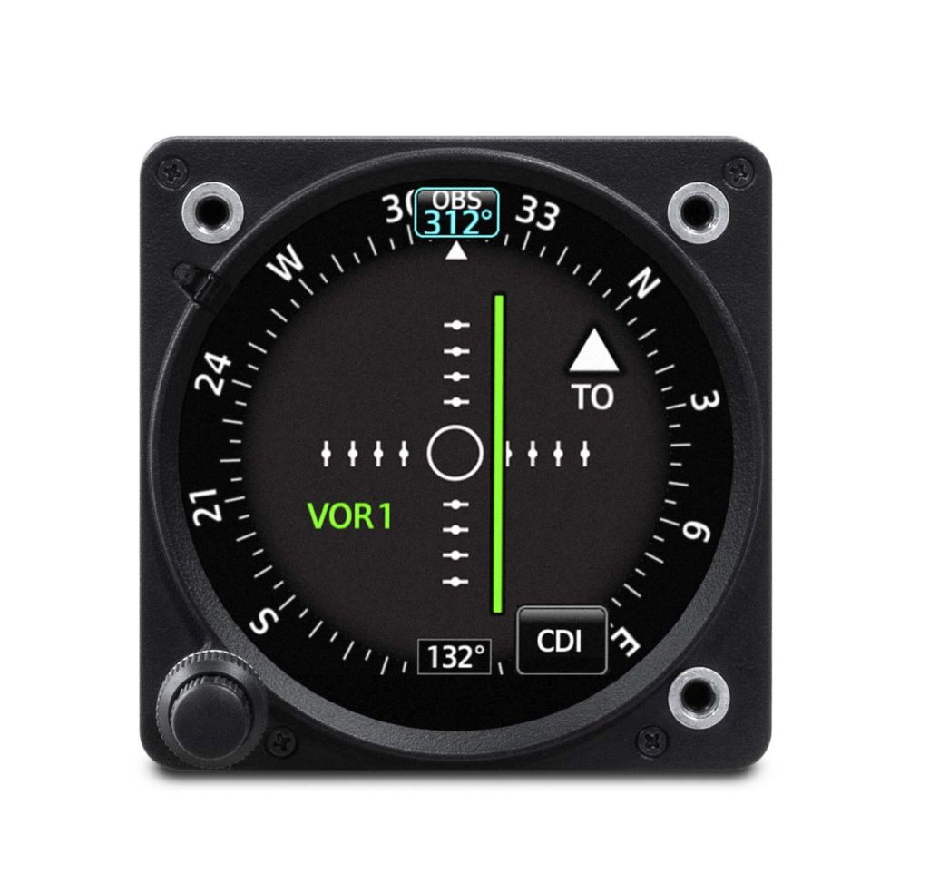
When installed as a CDI, the GI 275 is designed to accept a variety of GPS and navigation inputs, allowing up to two GPS sources and two VHF navigation sources. The GI 275 features an Omni Bearing Resolver that allows the flight instrument to interface to a variety of legacy navigators on the market. Vertical and lateral GPS, VOR/LOC and glide slope deviation can be viewed on the GI 275. When pilots replace an older mechanical CDI, the GI 275 doubles as a modern digital indicator and adds MFD-like capabilities such as a moving map, traffic and weather. MFD-like features add even more capability to the cockpit, including a moving map, MFD flight data, weather, traffic, SafeTaxi® airport diagrams, the display of radar altimeter information and more. The GI 275 can be paired with the GRA® 55/5500 and other third-party products to display radar altimeter data. Visual and aural annunciations are also available.
Built-in Wi-Fi® enables Database Concierge, the wireless transfer of aviation databases to the GI 275. Pilots also have the option to transfer databases to the GI 275 using a USB flash drive and the GSB 15 USB charger. Databases can also be synced among multiple GI 275 flight instruments in a single cockpit. Additional wireless functions include the sharing of GPS position and back-up attitude information with the Garmin Pilot mobile application.
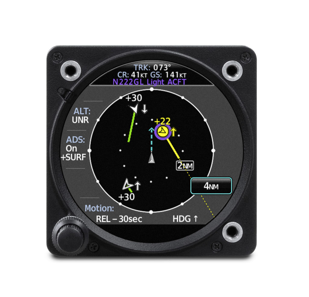
The GI 275 is available immediately for installation via Field Approval in select Part 27 FAA-registered helicopters as a CDI or MFD. Additional features and functions are expected to be approved via STC in Q4 2020. The GI 275 also comes with a two-year warranty and is supported by Garmin’s award-winning aviation support team, which provides 24/7 worldwide technical and warranty support. For additional information, visit www.garmin.com/aviation.
The post GI 275 Ready for Helicopter Installations appeared first on Garmin Blog.
https://www.garmin.com/en-US/blog/aviation/gi-275-ready-for-helicopter-installations/
Kansas City Group Educating Next Generation Aviators, Technicians
Believe it or not, the future of aviation is in America’s heartland — Ottawa, Kansas, to be exact. Ottawa is located on the outskirts of Kansas City, on the Kansas side of the border, some 30 miles southwest of the Garmin International headquarters. There a determined group of students are on a mission to give an aviation icon a 21st century makeover. The icon: a 1967 Piper Cherokee. The students — not yet enrolled in an aeronautical university — but rather a collection of ambitious middle school and high school students under the guidance of aviation industry professionals and mentors. The goal is not just to return the airplane to the sky but also to gain valuable aviation knowledge and technical skills.
The Aviation Explorers, the industry’s next generation
Founded in 2015, the Aviation Explorers Post 8000 was established as a nonprofit organization within the Boy Scouts of America. Its mission is to provide aviation learning and career-exploring opportunities for middle and high school students, as well as leadership and hands-on experiences that could translate to real-world career opportunities. Learning how to fly was a pillar for the group, and they were determined to find a way to reduce barriers and create more opportunities for aspiring young students to achieve this goal.

Vintage airplane, new avionics
Milton Scott — a lead aircraft maintenance technician in Garmin’s flight operations department — has been instrumental in helping establish the organization along with teaching and mentoring the students on the technical aspects of aviation. After helping to get the organization get off the ground, the Aviation Explorers received the generous donation of a 1967 Piper Cherokee. The goal was simple: return the aging airplane to airworthy status and learn about aircraft maintenance along the way. Having a flyable airplane in the organization would create a number of new opportunities, especially for those interested in learning to fly.
The original equipment in a ’60s-era airplane can leave a lot to be desired. So Garmin’s aviation team decided to help. They supplied a number of new cost-effective solutions tailored for training aircraft like Piper Cherokees, including a GNX 375 GPS navigator and ADS-B transponder, two GNC® 255 Nav/Comm radios and a GMA
 345 audio panel with BLUETOOTH® connectivity.
“The students worked on everything,” said Scott. “From setting up the radio racks, making the wiring harnesses, tying the wire harnesses, and installing the circuit breakers and headset/microphone sockets. They even tested all the wiring before applying power.”
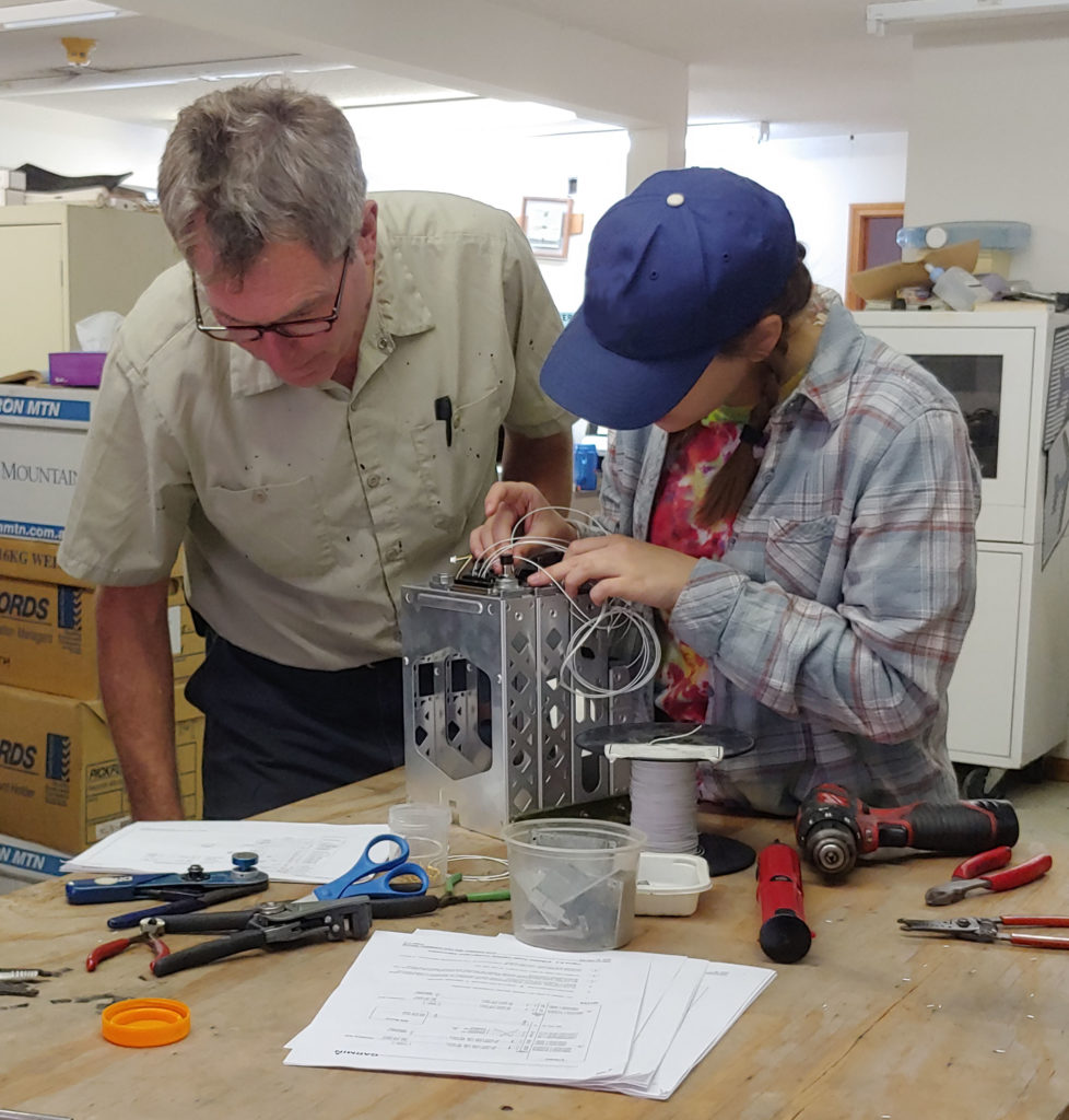
After updating the avionics, the students helped complete the remaining maintenance tasks required to return the aircraft to service.
“Right now, the airplane is available for any of our students to use for flight lessons,” Scott added. “They just have to pay for gas.”
That was their idea from the beginning. And they have succeeded — several students have earned or are close to earning their pilot’s license in the organization’s Piper Cherokee.
What’s next?
Although the airplane returned to flight and its mission of teaching student pilots, there is always room for improvement.
“We’re already planning to install two Garmin G5 electronic flight instruments, a GAD 29 (compact GPS/navigation data interface adapter) and GMU 11 (magnetometer) later this year,” Scott said.
For more information about our latest cost-effective avionics solutions, visit Garmin.com/aviation.
The Bluetooth word mark and logos are registered trademarks owned by Bluetooth SIG, Inc. and any use of such marks by Garmin is under license.
The post Kansas City Group Educating Next Generation Aviators, Technicians appeared first on Garmin Blog.
https://www.garmin.com/en-US/blog/aviation/kansas-city-group-educating-next-generation-aviators-technicians/
Garmin Pilot Adds Configurable Document Viewer, Night Mode and More
Garmin Pilot version 10.1 — now available on Apple mobile devices — brings enhanced capabilities, greater awareness and added convenience into the cockpit. New enhancements to the document viewer now allow customers to configure folders so they can more easily organize documents such as pilot’s guides, cockpit reference guides and more, within the app. Additional features include the display of elevation information in the radial menu, night mode on approach charts, the option to print the navigation log and more.
Document viewer enhancements
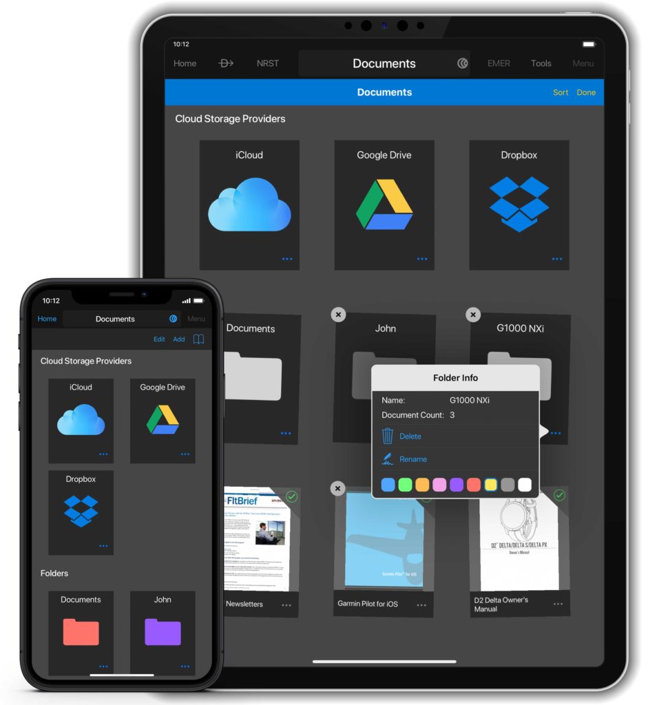
Documents stored within the document viewer in Garmin Pilot are now synced across all Apple mobile devices running Garmin Pilot. These folders are also customizable by color and can be reordered for improved organization of documents such as pilot’s guides, cockpit reference guides, checklists and more.
Night mode on instrument approach charts
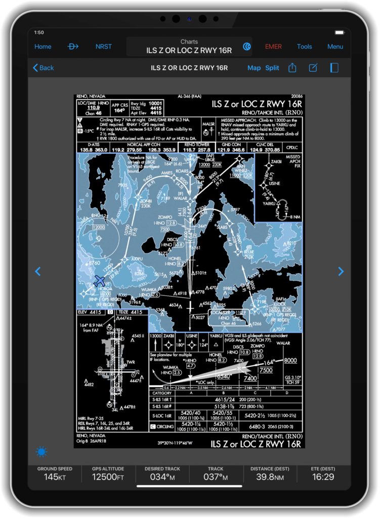
While flying at night, pilots can now invert the colors on terminal charts, including Garmin FliteCharts or Jeppesen Terminal Approach procedures, for enhanced readability during night flights. When viewing a chart on the map page, within the charts binder, in split-screen view on the synthetic page or while viewing the airport page, pilots have the option to select night mode from the menu in the top right corner within Garmin Pilot. Once selected, night mode is consistently displayed throughout the app.
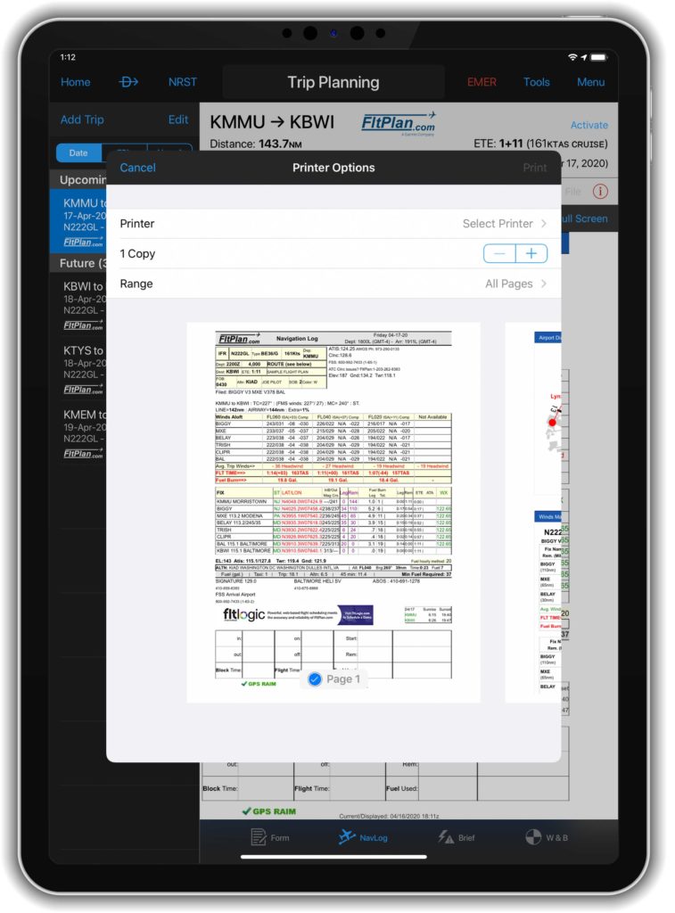
Navigation log and weight & balance print option
Garmin Pilot uses Apple’s wireless printing technology, AirPrintÒ, to print airport diagrams, FliteCharts, Jeppesen charts, weight & balance load sheets, navlogs, as well as European IFR autorouting briefing packs.
Additional features:
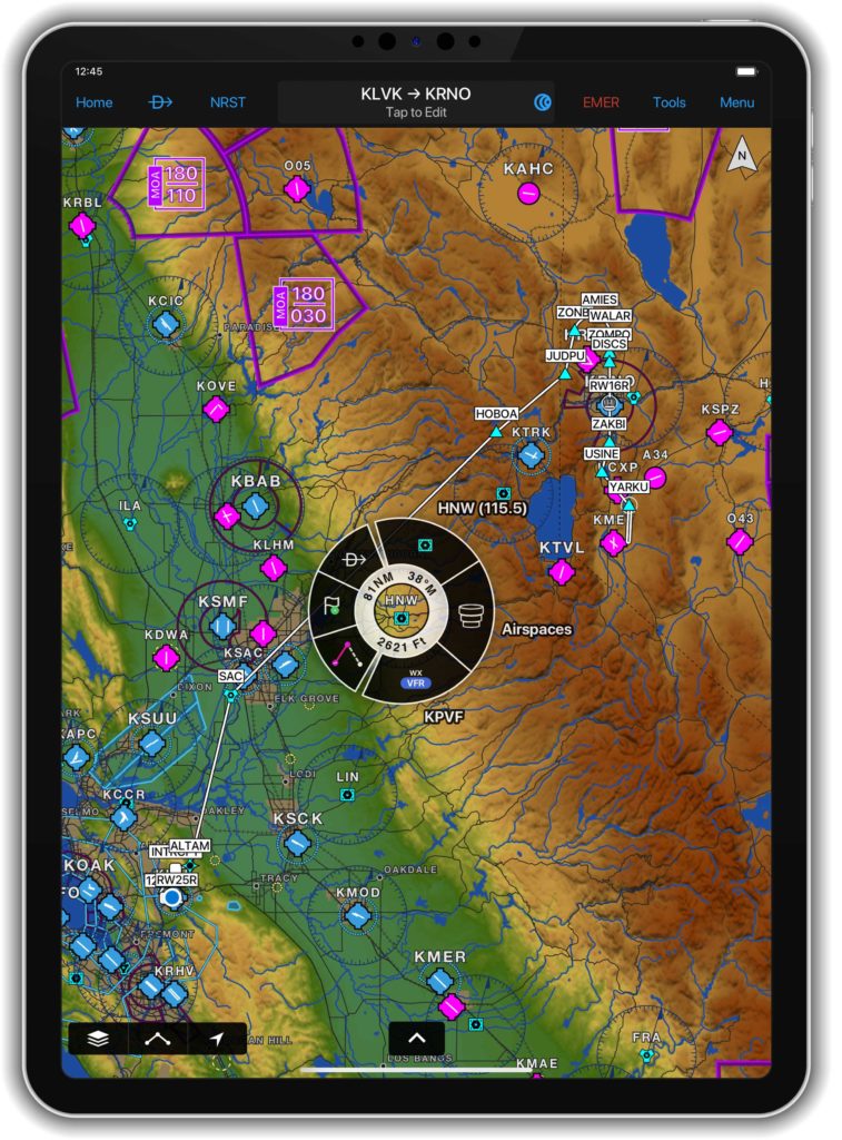
- When the terrain database is downloaded, elevation information can be viewed within the inner circle of the radial menu on the map for pre-flight planning.
- Pilots can easily view a new logbook report that details the airports they have visited. Each logbook period displays a map with pins to reflect the destination airport, as well as the date, flight time logged and more.
- The display and animation of lightning has been enhanced on the moving map.
- Garmin Pilot also supports the Apple Pencil 2 and a variety gestures.
- New fields have been added to the logbook entry that allow pilots to record the current oil level, oil added, as well as document squawks experienced with the aircraft during the flight.
The newest release of Garmin Pilot on Apple mobile devices is available immediately. For new customers, Garmin Pilot is available in the Apple App Store as a free download for the first 30 days. After the 30-day trial period, customers may purchase an annual subscription of Garmin Pilot starting at $79.99. Garmin Pilot is supported by our award-winning aviation support team, which provides 24/7 worldwide technical and warranty support. Visit www.garmin.com/aviation for additional information.
The post Garmin Pilot Adds Configurable Document Viewer, Night Mode and More appeared first on Garmin Blog.
https://www.garmin.com/en-US/blog/aviation/garmin-pilot-adds-configurable-document-viewer-night-mode-and-more/
Appareo Releases New Product Line of Telematic and Connectivity Solutions for Aviation
NEWS RELEASE
Appareo Releases New Product Line of Telematic and Connectivity Solutions for Aviation
Conexus® Aircraft Communication Units are highly-capable, well-connected mobile computers for a broad range of aircraft types
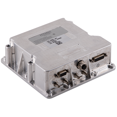
FARGO, North Dakota (June 3, 2020) — Appareo today announced the release of a new product line of Conexus® Aircraft Communication Units (ACUs). These units are lightweight computing and communications devices that function as a data acquisition system for flight data monitoring (FDM) or flight operations quality assurance (FOQA) programs for fleet operators, or as a telematic and connectivity product for airframe manufacturers. The first product in this line, the ACU-200, is already being installed in multiple aircraft.
The ACU-200 can connect with aircraft systems, avionics, or engines using Ethernet, ARINC 429, or RS-422. The unit is qualified against RTCA DO-160G, and is designed with cybersecurity in mind. Additionally, the ACU-200 features very low power states, allowing Appareo customers to remotely connect to the unit and retrieve data even while the aircraft is powered down. The Conexus line is designed to be used in both fixed and rotary wing applications.
For airframe manufacturers, the Conexus ACU-200 is a helpful tool for monitoring the usage of aircraft in the fleet — providing valuable statistics to inform predictive maintenance scheduling, prediction of service work, and to improve depot and part distribution activities to ensure maximum customer uptime. For operators, the Conexus ACU-200 offers a single FDM/FOQA data recorder solution capable of being fit across a broad spectrum of aircraft in a mixed fleet, easing the challenges of integration and data offload logistics.
“FDM or FOQA programs are valuable for fleet operators to monitor trends, identify areas of risk, and deploy training programs to mitigate those risks. However, it can be a challenge for mixed-fleet operators to effectively analyze their flight data when it is collected in multiple acquisition systems” said David Batcheller, President & CEO of Appareo. “The ACU-200 is an ideal solution for those programs because it was designed for use in both modern and legacy aircraft,” Batcheller said.
Using the onboard inertial and GPS capabilities, the ACU-200 can provide an actionable volume of flight data from any kind of aircraft without needing to interface with avionic systems. For aircraft with digital buses available, the ACU-200 can acquire flight data directly from the aircraft system. This allows the ACU-200 to be implemented as a single avionic solution for a mixed fleet.
Additionally, while many flight data acquisition systems rely on physical means of transporting information (e.g., requiring operators to remove SD cards from their flight data recorders in order to transfer the data to a computer), Conexus products offer global 4G/3G/2G cellular data offload capabilities, ensuring the maximum speed of data reception while simplifying system maintenance and reducing costs.
The ACU-200 can be integrated with other Appareo products, such as the Vision 1000 to provide cockpit image and audio data for cellular offload, or with the RDM-300 to provide crash-hardened storage of the data acquired by the ACU-200.
“More than ever, the world recognizes the importance of making data work for us,” said Batcheller. “By developing the Conexus line of telematic and connectivity products that can perform alone or be integrated with our other flight data recording and storage solutions, Appareo is offering an approachable, expandable way for customers to access their data and put it to work.”
Find full product specifications on the ACU page, or contact Appareo for information about pricing.
About Appareo
Founded in 2003, Appareo pioneered FDM for light fixed-wing aircraft and rotorcraft by producing the most compact and lightweight flight data recorder available. Currently, multiple airframe manufacturers utilize Appareo data recording products as standard equipment on their aircraft. Appareo’s accompanying FOQA software suite was named “Product Breakthrough of the Year” by Aviation Week & Space Technology in 2007. Appareo then became the industry leader in the design and production of ADS-B equipment for general aviation, after introducing the first StratusTM portable ADS-B receiver in 2012, and subsequently introducing a series of certified and non-certified Stratus products designed to advance situational awareness and safety, increase pilot comfort, reduce pilot workload, and improve the flying experience for aviators.
Appareo is a recognized leader in the custom design, development and manufacture of innovative electronic and software solutions for aerospace. Through the creative application of cutting-edge technologies, Appareo creates complex end-to-end solutions that include both mobile and cloud-based components. The company is privately held, with headquarters in Fargo, N.D., and design offices in Tempe, Ariz. and Paris, France. All products are built and supported in the USA.
# # #
Conexus and Stratus are registered trademarks of Appareo Systems, LLC. ©2020
https://www.appareo.com/2020/06/03/appareo-releases-new-product-line-of-telematic-and-connectivity-solutions-for-aviation/
Prop Talk Webinar Series

TUESDAY, JUNE 9 | 11 AM CENTRAL TIME
Our Prop Talk Series continues! Join Kris Garberg, President of Appareo Aviation, as he walks through some Stratus Insight tips and tricks, specifically showing features like the Vertical Weather Profile, Radar Forecast, and how to submit PIREPS. There will also be an interactive Q&A session at the end of the webinar.
Please note: It will be helpful to have a Stratus Insight account so you can interact with the app during the webinar, so be sure to take advantage of our 30 day free trial! You can find Stratus Insight in the Apple App Store.
Click here to register for the webinar.
*Registration is limited
https://www.appareo.com/2020/05/27/prop-talk-webinar-series/
New Aircraft Models Approved for GFC 500 and GFC 600 Autopilots
Our GFC 500 and GFC 600 digital autopilots have received FAA Supplemental Type Certification in several aircraft models. The GFC 500 and GFC 600 deliver superior in-flight characteristics, self-monitoring capabilities and minimal maintenance needs when compared to older generation autopilot systems. The GFC 500 is intended for piston aircraft, while the GFC 600 is intended for high performance piston and turbine aircraft that have a wide range of speed and performance characteristics.
New aircraft models approved for the GFC 500 autopilot include:
- Aviat Husky
- Models: A-1, A-1A, A-1B, A-1C-180, A-1C-200
- Cessna 206
- Models: U206F (s/n U20602200 and later), TU206F (s/n U20602200 and later), U206G, TU206G, 206H, T206H
New aircraft models approved for the GFC 600 autopilot include:
- Cessna 425
- Models: 425
The GFC 500 autopilot uniquely integrates with the G5 electronic flight instrument or a combination of both the G5 electronic flight instrument and G3X Touch, G500 TXi or G500 flight displays to provide pilots with an economical and modern autopilot solution. The GFC 600 is designed as a standalone autopilot and also boasts superior integration potential when paired with the G500 TXi/G600 TXi or G500/G600 glass flight displays, Garmin navigators, as well as a variety of third-party flight displays, instruments and navigation sources.

The full-featured GFC 600 and GFC 500 autopilots provide thousands of existing general aviation aircraft with a simple, light-weight, cost-effective autopilot upgrade path. The GFC 600 and GFC 500 incorporate solid state attitude with robust self-monitoring capabilities to provide superior autopilot performance, greater reliability and safety benefits that are similar to the popular GFC 700 autopilot. In addition to traditional autopilot capabilities such as altitude hold, vertical speed and heading modes, the GFC 600 and GFC 500 also include altitude preselect, VNAV1, Level Mode, underspeed and overspeed protection and more. Pilots can also select, couple and fly various instrument approaches, including GPS, ILS, VOR, LOC and back course approaches when paired with a compatible GPS navigator.
As a standard feature on both the GFC 500 and GFC 600 autopilots, pilots receive Garmin Electronic Stability and Protection (ESP), which works to assist the pilot in maintaining the aircraft in a stable flight condition. ESP functions independently of the autopilot and works in the background to help pilots avoid inadvertent flight attitudes or bank angles and provides airspeed protection while the pilot is hand-flying the aircraft.

For customers who already have a G5 electronic flight instrument, the GFC 500 starts at a suggested retail price of $6,9952 for a 2-axis autopilot. The GFC 600 autopilot starts at a suggested retail price of $19,9952 for a 2-axis autopilot with electric pitch trim. Pricing is for retrofit installations only. The GFC 500 autopilot will also be available as an option on new Aviat Husky aircraft.
Garmin continues to add additional aircraft models to the growing STC list for the GFC 500 and GFC 600 autopilots. To view the most up-to-date aircraft STC list, to view certification programs that are expected to begin in the next 12-months, or to express interest in a specific aircraft make/model, visit: www.garmin.com/GFC500 or www.garmin.com/GFC600.
1. GTN navigator required
2. Installation not included
The post New Aircraft Models Approved for GFC 500 and GFC 600 Autopilots appeared first on Garmin Blog.
https://www.garmin.com/en-US/blog/aviation/new-aircraft-models-approved-for-gfc-500-and-gfc-600-autopilots/
Garmin Autoland Achieves FAA Certification for General Aviation Aircraft
Garmin Autoland is now FAA certified and available on the G3000 integrated flight deck in the Piper M600. In the event of an emergency, Autoland will control and land the aircraft without human intervention. The award-winning system is also featured on the Cirrus Vision Jet and Daher TBM 940 and will soon be available on these aircraft, with additional aircraft approvals to follow.
“What started as a vision to develop the world’s first Autoland system for general aviation, became a reality today as we deliver one of the industry’s most significant innovations,” said Phil Straub, Garmin executive vice president and managing director of aviation. “Congratulations to the entire Garmin team who contributed to the development and certification of Autoland – one of the industry’s most forward- thinking technologies that will forever enhance aviation safety and save lives.”
In the event of an emergency, the pilot or passengers on board the aircraft can activate Autoland to land the aircraft with a simple press of a dedicated button. Autoland can also activate automatically if the system determines it’s necessary. Once activated, the system calculates a flight plan to the most suitable airport, while avoiding terrain and adverse weather, initiates an approach to the runway and automatically lands the aircraft – without pilot or passenger intervention.

Autoland takes into account a breadth of information and criteria during an activation, including a wide range of performance, operational and environmental factors. The availability of a GPS approach with lateral and vertical guidance to the runway is also required when the system is considering various airports and runways. Even further, the system will automatically communicate with air traffic control, advising controllers and pilots operating near the aircraft of its location and its intentions.
Throughout an Autoland activation, the G3000 integrated flight deck provides passenger-centric visual and verbal communications in plain-language so passengers in the aircraft know what to expect. The flight displays show the aircraft’s location on a map alongside information such as the destination airport, estimated time of arrival, distance to the destination airport and fuel remaining. Airspeed, altitude and aircraft heading are also labeled in an easy-to-understand format. Passengers also have the option to communicate with air traffic control by following simple instructions on the display using the touchscreen interface on the flight deck.
The Garmin Autothrottle system is used to automatically manage aircraft speed, engine performance and engine power so the aircraft can climb, descend or maintain altitude as needed during an Autoland activation. On approach to land, the system initiates a controlled descent to the airport. If the aircraft needs additional time to descend or slow down during the approach, the Autoland system initiates a standard holding procedure. When aligned with the runway, the landing gear and flaps are automatically extended and the aircraft continues its descent. On the runway, automatic braking is applied while tracking the runway centerline to bring the aircraft to a full stop. Engine shutdown is also automated so occupants can safely exit the aircraft.
At any time, a pilot can easily deactivate an Autoland activation. With a single press of the “AP” autopilot key on the autopilot controller or the autopilot disconnect button on the controls, an Autoland activation can be canceled. The flight display shows a message that confirms Autoland has been deactivated and in the event of an accidental deactivation, the system shows passengers how to reactivate Autoland if needed.
Garmin Autonomí, a family of autonomous safety solutions, encompasses Autoland, Emergency Descent Mode (EDM) and Electronic Stability and Protection (ESP). These technologies add to the safety enhancing tools and capabilities of a Garmin-equipped flight deck. For example, in the event an aircraft loses pressurization, EDM is capable of automatically descending the aircraft to a preset altitude without pilot intervention to help avert hypoxic situations.
ESP further enhances the Autonomí suite by working to assist the pilot in avoiding unintentional flight attitudes beyond that for normal flight. ESP works in the background while the pilot is hand flying the aircraft to help pilots avoid inadvertent flight attitudes or bank angles. Should the pilot become inattentive while hand flying the aircraft and exceed pre-determined pitch, roll or airspeed limitations, Garmin ESP activates and the pilot will feel pressure on the flight controls that guide him/her back to a recommended flight limit.
For additional information regarding the Garmin Autonomí family of autonomously activated flight technologies, visit www.garmin.com/Autonomi.
The post Garmin Autoland Achieves FAA Certification for General Aviation Aircraft appeared first on Garmin Blog.
https://www.garmin.com/en-US/blog/aviation/garmin-autoland-achieves-faa-certification-for-general-aviation-aircraft/
Appareo Releases Major Upgrade to Web-Based Flight Data Analysis Software
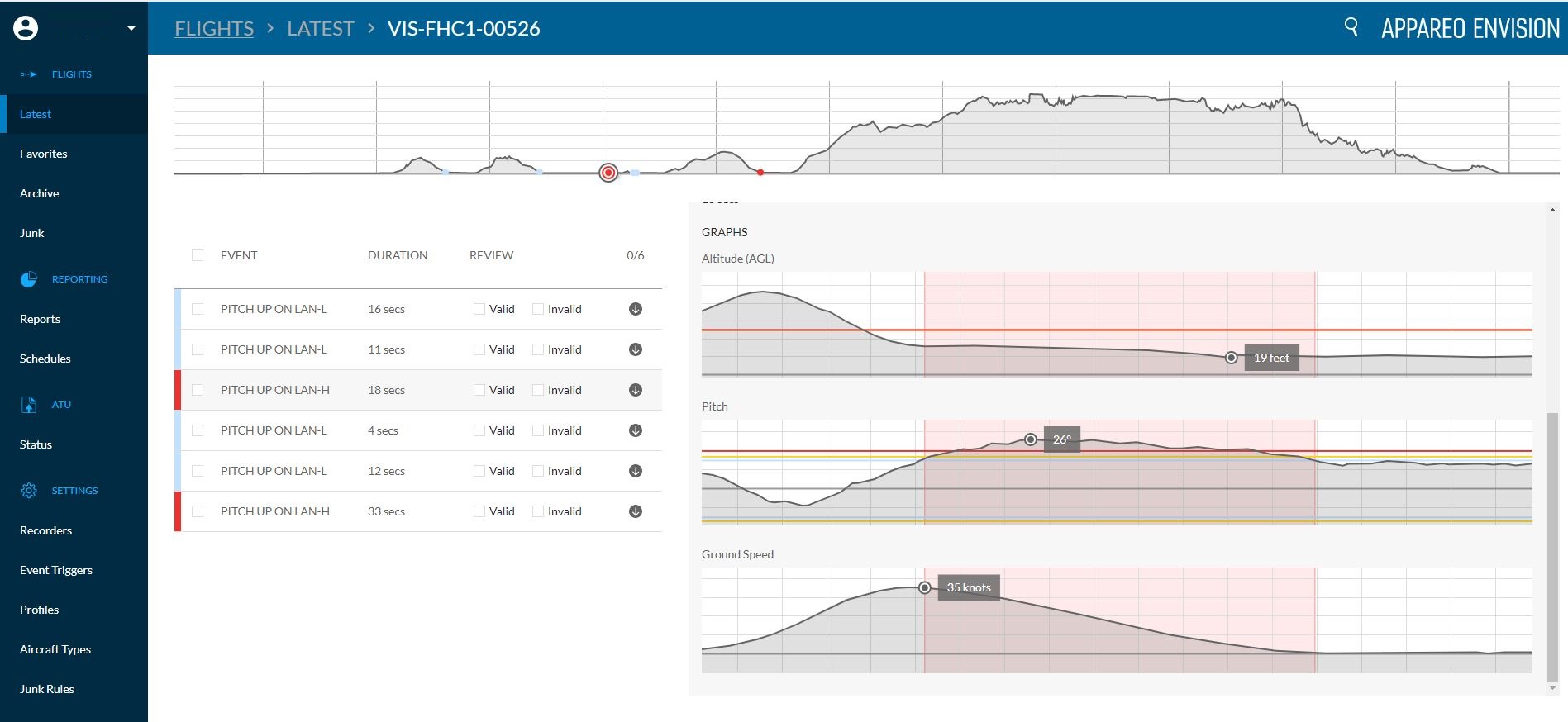
FARGO, North Dakota (May 18, 2020) — Appareo today released a major architectural upgrade to Appareo EnVision, the company’s analysis software system for Flight Data Monitoring (FDM) or Flight Operations Quality Assurance (FOQA) programs. Appareo EnVision is a web-based application that allows fleet operators to access past and current flight data, generate detailed reports, and trend the safety improvements in their operations. Prior to this release, the software accepted flight data captured by Appareo’s Vision 1000 cockpit recorder. With this architectural rewrite, the Appareo EnVision web app can now accept flight data from other devices, including other Appareo flight data recorders and even third-party sources.
“While many flight analysis applications require significant technical capability to operate with effectiveness, EnVision was built with a focus on ease of use” said David Batcheller, President & CEO of Appareo. The software provides deep access to raw data while delivering it in a simple, clean interface to automatically filter flight data and identify flights that require further review.
The Importance of Flight Analysis
FDM and FOQA programs have proven effective in improving safety and decreasing the occurrence of incidents or accidents when the program follows three simple practices: 1) identify deviations, 2) implement corrective actions, and 3) measure results.
Identifying deviations from standard operating procedures (SOP) is not an indication of irresponsible or deliberately malicious behavior by pilots. Deviations often occur because humans are susceptible to the “normalization of deviance.” This phrase describes a process in which deviance becomes normalized if it doesn’t result in an instantaneous negative consequence. While some operating procedures may seem inconvenient or unimportant, the right mix of variables could result in a deviance turning deadly. That is the reason behind the expression, “aviation regulations are written in blood.”
Appareo CEO David Batcheller shares his own personal experience with normalization of deviance: “I moved into a new neighborhood which had a stop sign near my house. For months I didn’t see another car when I came to the stop sign every day. After a while, I started to roll through the stop, then coast through the stop, and eventually I forgot the stop sign was there entirely. Flash forward to harvest season when I discovered that the intersection became very busy, and I was nearly broadsided by a truck as I ignored the stop sign. Fortunately that was a near miss, but that incident could have been fatal. It’s the kind of thing that routinely happens in all walks of life, flight operations included. Flight Data Monitoring and Flight Operations Quality Assurance programs should be thought of as the kindly local sheriff in the rearview mirror who is ready to provide a reminder that rules are important when our more fallible human inclinations take over.”
How It Works
Data is transferred from an aircraft to a local computer via SD card, then uploaded to Appareo servers for analysis. That transmission can happen instantaneously or it can be scheduled for a different time of day, based on the user’s preferences. “The scheduling feature was developed for our customers who have operations in remote locations with limited internet bandwidth,” said Batcheller. “They appreciate the ability to schedule their data file transmission to take place during periods of low network activity.”
Once data is received, the EnVision software parses all flight data against customized event triggers that were defined by the user based on their organization’s flight operating procedures. The process of configuring those event triggers is one of EnVision’s most powerful features; using a simple interface and drop-down menu, users can define the events that are important to monitor, and specify the parameters that indicate when a flight has deviated from flight ops.
Detailed reports are easily generated from those events, delivering the information that operators want to monitor and the ability to trend that information over time. Comprehensive data for every flight is archived on the Appareo servers, giving customers convenient online access to their data whenever it’s needed.
Appareo EnVision is offered as a per-aircraft subscription service with no user limits, and includes the hosting of stored flight data. To learn more about Appareo’s turnkey flight data monitoring solutions, visit Appareo.com/FDM-FOQA.
# # #
About Appareo
Appareo is a recognized leader in the custom design, development and manufacture of innovative electronic and software solutions for aerospace. Through the creative application of cutting-edge technologies, Appareo creates complex end-to-end solutions that include both mobile and cloud-based components. The company is privately held, with headquarters in Fargo, N.D., and design offices in Tempe, Ariz. and Paris, France. All products are built and supported in the USA.
About FDM and FOQA
FDM and FOQA programs are one of the NTSB’s Top 10 Most Wanted and an area of strong recommendation from the NTSB to the FAA for new rulemaking to improve the safety of Part 135 operations.
Media Assets
www.appareo.com/media
https://www.appareo.com/2020/05/18/appareo-releases-major-upgrade-to-web-based-flight-data-analysis-software/
ATC Radio Transcription & Playback is available with Stratus Insight
This new AI technology is the baseline for exciting features we have in our app roadmap, which is focused on creating a safer, more convenient way to fly.
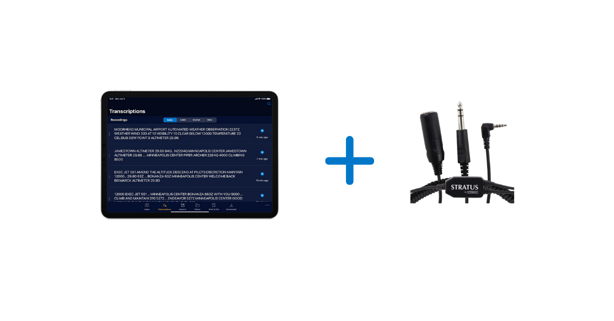
When paired with a Stratus Audio Cable, the ATC Radio Transcription feature works similar to visual voicemail. ATC communications are converted into text and displayed directly above the audio playback line, providing a helpful visual assist for referencing previous audio clips. This enables pilots to receive a clearance, ATIS, or other important ATC communications without needing to write them down.
The speech recognition and language understanding technology that drives the Radio Transcription feature was custom-designed by our Artificial Intelligence (AI) division.
At a global scale, speech recognition, translation, and transcription features are commonplace (e.g. Alexa and Siri). However, ATC communications present many challenges for these common speech recognition systems. The high rate of speech, noisy signal, narrow frequency band, and unique location identifiers are among those challenges. We identified that shortfall in the existing technology and set out to develop a speech recognition system customized for aviation.
We also use Natural Language Processing to interpret the output of the speech recognition system and present it in a more pilot-friendly format. For example, tail numbers, altitudes, runways, and frequencies are transcribed in a way that will be more helpful to pilots.
Comparison example:
| A typical speech recognition system | Appareo’s custom aviation speech recognition system | |
| Altitudes | one zero ten thousand | 10,000 |
| Call signs | November two two eight four quebec | N2284Q |
| Runway | Runway three six one eight | runway 36 18 |
| Frequencies | one two zero point four | 120.4 |
The Stratus Audio Cable available to purchase and is necessary to enable the Radio Transcription and Playback features. For more information, visit www.stratusinsight.app.
Download Stratus Insight today and take advantage of our 30 day free trial.
https://www.appareo.com/2020/05/14/atc-radio-transcription-playback-is-available-with-stratus-insight/
