All posts by webadmin
Understanding 4G LTE Categories
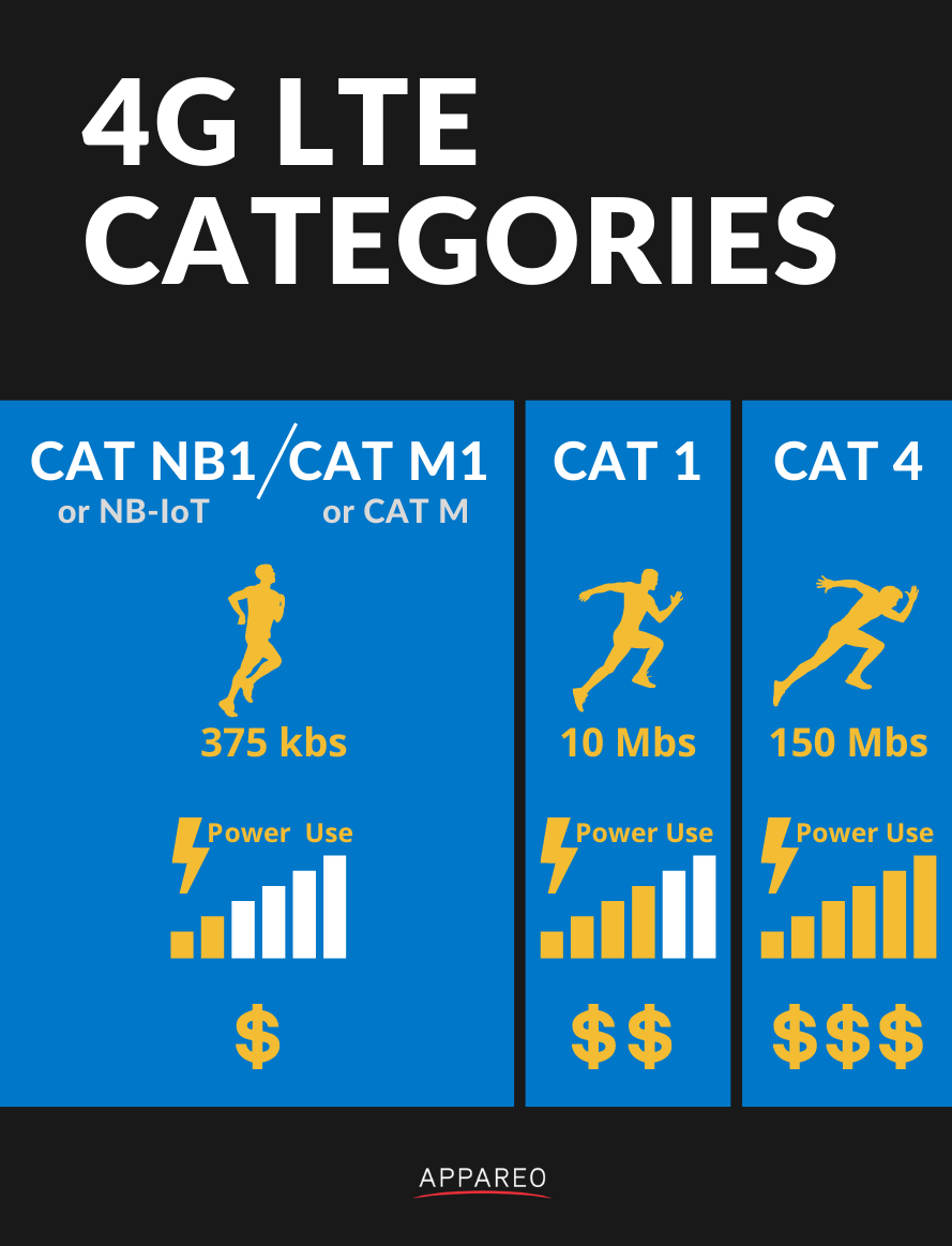
LTE consists of a range of different categories of modem, which can be integrated into telematic devices. These different categories include:
-
- CAT NB1 (also referred to as NB-IoT)
- CAT M1 (also referred to as CAT M)
- CAT 1
- CAT 4
In general, as you progress down the list above, the power consumption, throughput, and price of the devices increases (all considerably). When comparing specifications and capabilities of different telematic devices, it can be difficult to know what is the right level of capability for your cellular data transfer needs. This post will provide a brief summary and application-level insight to this area of potential confusion when specifying or purchasing telematic products.
NB-IoT and M1
Although these newer, low-energy cellular technologies are grouped together, they are not exactly the same thing. Most hardware that supports one also supports the other, so you can prototypically get both capabilities in a single package. This is new and cool, and will continue to grow in things it can accomplish within the geographies where it can be deployed.
Although you’ll hear NB-IoT and M1 discussed in the context of vending machines, pollution monitors, electric meters, and wearables, these technologies absolutely have a role to play in mobile vehicles and equipment. Here is what’s great about both NB-IoT and M1:
- Very low power
- Provide superior range over CAT 1 and CAT 4 modems (our testing has shown that NB-IoT and M1 devices frequently have cellular connectivity in areas where cell phones do not)
- Lowest cost of any cellular components or data plans
- Deploys using existing cellular infrastructure, so lots of new support is expected to come online
- Secure
As my mother always told me growing up, nothing is free. There’s a trade-off for the lower power consumption, lower price, and improved range of the NB-IoT and M1 technologies. Here’s what you spend to get that goodness:
- Lower data rate (~375 kbs)
- Higher latency for wake-up applications
If you have a few sensor parameters, or a couple of buses of CAN data, to send on M1 is a great technology for mobile applications.
CAT 1
This is the bread and butter of telematic connectivity technologies. LTE CAT 1 is capable of supporting feature-rich telematic products with enough throughput to support streaming meaningful amounts of data while vehicles are on the go. The maturity of the technology makes it broadly available in a large number of geographies, with mature modem hardware and firmware support and a full-featured build-out of carrier capabilities. This technology is a little more expensive than NB-IoT and M1, but has the following advantages over those technologies:
- Higher data streaming throughput (up to 10 Mbs)
- Lower latency for wake-up applications
- Broader global coverage
If you need to deploy a solution broadly for mobile equipment (touching dozens of countries), need to offload a fairly large amount of machine data in a hurry, or require support for streaming video or other data-intensive content, then CAT 1 is going to be the way to go for your application.
CAT 4
LTE CAT 4 modems can absolutely scream data. These modems can hit 150 Mbs, more than ten times the throughput of their CAT 1 counterparts. They are also complex, expensive, and power hungry. These modules are typically reserved for spaces like the handset market. Unless you need to aggregate a lot of data from a lot of machines, or provide streaming services to a large number of passengers onboard a vehicle, it is unlikely that the cost or complexity of this technology will be appropriate for your mobile application.
 David Batcheller – President & CBO
https://www.appareo.com/2020/11/09/understanding-4g-lte-categories/
Garmin Autoland Receives Aviation Week Network Grand Laureate Award
Garmin Autoland has earned another prestigious honor — Aviation Week Network’s 2020 Grand Laureate Award in the Business Aviation category. For 63 years, the Aviation Week Network has awarded the Grand Laureate for extraordinary aviation and aerospace achievements that embody the spirit of exploration, innovation and vision that inspire others to strive for progress, change and leadership.
“We are humbled and honored to be recognized by Aviation Week Network with this prestigious award in the Business Aviation category for the innovation of Autoland,” said Phil Straub, Garmin executive vice president and managing director, aviation. “The passion and commitment to safety through revolutionary developments like Autoland is shared by the entire Garmin team, who continuously drive our pioneering vision to develop advanced technologies that enhance aviation safety and potentially save lives.”

The Grand Laureate Award adds to a growing list of accolades Garmin Autoland has earned to date. Earlier this year, Fast Company recognized Autoland as a finalist in its 2020 World Changing Ideas Awards category, ultimately taking home honorable mention in the all-encompassing Best World Changing Idea Award in North America. The Kansas City Tech Council awarded Garmin with its 2020 Outstanding Contribution to Tech Award for Autoland — an honor presented to organizations that developed, or partnered in developing, a product or service that significantly advances the tech industry in their respective field. Autoland also reached the finals in the Kansas Manufacturing Council’s Coolest Thing Made in Kansas competition.
Garmin Autoland is certified in three 2020 model year aircraft — Piper M600 SLS, Cirrus Vision Jet and Daher TBM 940. In an emergency where the pilot is unable to fly, Autoland can take complete control of the aircraft, autonomously navigate around hazardous terrain, obstacles and weather while communicating with air traffic control and passengers. The system automatically selects the best airport for landing, considering runway length, distance, fuel range and other factors, and autonomously flies the approach and landing to a full stop on the runway¹. For more information about Autoland or our suite of Autonomi autonomous safety-enhancing technologies, visit Garmin.com/autonomi.
¹See Garmin.com/ALuse for Autoland system requirements and limitations
The post Garmin Autoland Receives Aviation Week Network Grand Laureate Award appeared first on Garmin Blog.
https://www.garmin.com/en-US/blog/aviation/garmin-autoland-receives-aviation-week-network-grand-laureate-award/
Choosing the Bluetooth That’s Right For You
Since the introduction of Bluetooth Low Energy (BLE) in Bluetooth 4.0, there are now four technologies used under Bluetooth 4.0 and later revisions. Although the history of naming these technologies has led to much confusion, the generally accepted names are Bluetooth Classic and Bluetooth Low Energy. Bluetooth Classic represents the BR, EDR, and HS (AMP) technologies, while Bluetooth LE represents the LE technology.
Bluetooth Classic devices are typically used in applications requiring streaming of data, such as audio. The physical layer and protocol of BR/EDR make socket-like streaming of data easy to accomplish. Rates of these data streams may be around 2-3 Mbps.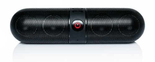 Bluetooth Low Energy brings about some great features beyond low energy operation, such as one-to-many and many-to-many communications, as well as connectionless services. BLE is often used for data transmission, location services, and device network applications. These interactions operate much more like a shared database of characteristics through the use of a Generic Attribute Profile (GATT). Most mobile devices such as phones, tablets, and computers support both Bluetooth Classic and Low Energy; however, many devices use one or the other.
Due to the differences in the physical layer modulation and demodulation, BLE cannot talk with Bluetooth Classic and vice versa. Similarly a BLE device cannot use Bluetooth Classic network and transport protocols when talking to a dual mode Bluetooth device. This is critically important for machinery manufacturers because although Bluetooth devices can typically communicate over a local area network to tablets and phones reliably, if you are going to use Bluetooth to communicate between machines and attachments, or between machine ECUs, you’ll need to select a protocol for the network of devices you’re managing.

- BLE can manage the data rates necessary to transfer typica data loads from mobile equipment busses (e.g. CAN buses running J1939)
- Bluetooth Classic can handle a lot more data
- Bluetooth Classic supports mobile devices tethering to telematic gateways or control units onboard machines and letting one device use the other’s data plan
- Bluetooth Classic is much more energy intensive than BLE, so if you have a battery-powered application BLE is the way to go
In summary, if you have a network demand for a fairly large amount of data, and you have access to vehicle power (or battery life management is not a concern), Bluetooth Classic is a good way to go. If you’re a battery-powered application or do not require transfer of significant volumes of data, BLE provides attractive networking flexibility, low power, and a low price.
 Michael Hoffman – Sales Manager, Land Mobile
https://www.appareo.com/2020/11/02/choosing-the-bluetooth-thats-right-for-you/
G500 TXi and G600 TXi Flight Display Enhancements Now Available
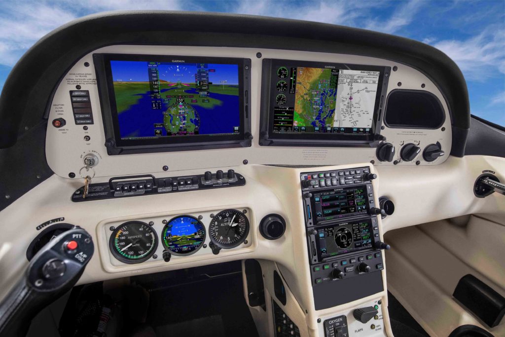
Our G500 TXi and G600 TXi flight displays can now bring more capabilities to cockpit upgrades. Cirrus SR20/SR22 aircraft equipped with either legacy Avidyne flight displays or original flight instruments can now upgrade to the G500 TXi to display engine information. Additional enhancements to the TXi flight display series include DFC90 autopilot compatibility, new multi-function display (MFD) configurations, the display of additional engine parameters such as percent power and more. GFC
 500 autopilot support is also expected for SR22/SR22T aircraft later this year. Also new, the turbine-engine equipped Piper PA46-500TP Malibu Meridian is compatible with the Engine Indication System (EIS) on the G500 TXi and G600 TXi flight displays. These upgrades are now available through select authorized Garmin dealers.
Cirrus SR20/SR22 TXi EIS display options
Cirrus aircraft equipped with legacy Avidyne flight displays can now easily upgrade to the G500 TXi to receive modern features and display capabilities, including the display of engine indications. Engine information such as percent power, turbocharged engine information, as well as support for electrical gauges displaying up to six parameters are also now available.
GFC 500 autopilot for the SR22/SR22T and Avidyne DFC90 autopilot compatibility
The GFC 500 is expected to be available for Cirrus SR22/SR22T aircraft models later in Q4, which will include features such as our Electronic Stability and Protection (ESP ), descent vertical navigation (VNAV1) and more. The G500 TXi and G600 TXi systems are compatible with the Avidyne DFC90 autopilot in Cirrus SR20/SR22 aircraft models. When interfaced with an existing DFC90, both the G500 TXi and G600 TXi supports mode annunciation and full bug synchronization on the primary flight display (PFD). For added redundancy in aircraft equipped with dual attitude and heading reference system (AHRS), the DFC90 can utilize both sources of AHRS data. In the unlikely event of an AHRS failure, pilots have the option of selecting which AHRS source to use, allowing the autopilot to remain fully functional.
New display page configurations and additional features
The 10.6-inch TXi flight display now features an MFD/EIS layout design, showing EIS data in a single strip on either side of the flight display that occupies 20% of the display. As an example, pilots now have the option of displaying moving map information on the remaining 80% of the flight display, or they can evenly split that into two windows (40% and 40% respectively) to show the moving map alongside an approach chart.

Turbine aircraft EIS
The Piper PA46-500TP is the latest addition to a growing list of aircraft that are capable of interfacing with the TXi system to display EIS information. Pratt & Whitney PT6A turboprop engine display compatibility is currently available for several popular aircraft models, including the Cessna 208/208B, Daher TBM 700/TBM 850 and the PA46-310P/350P JetPROP. The Piper PA46-500TP is compatible with the G500 TXi & G600 TXi and can display EIS information alongside PFD/MFD information on a single display. Features of the EIS system for turbine aircraft include engine timers, exceedance recordings, dynamic engine indications, as well as wireless data logging that combine to improve engine efficiency and reduce maintenance costs.
Additional features of the latest TXi upgrade include:
- When the G500 TXi & G600 TXi is paired with the GTN
 /GTN Xi series and the GFC 500 autopilot, the system performs automatic GPS-to-LOC switching.
 - Percent power can be viewed on the TXi displays for single-engine and twin piston, as well as turboprop aircraft.
- Fuel quantity display compatibility expanded to include aircraft that have up to six fuel tanks.
- Select twin Cessna aircraft with four fuel tanks are now capable of displaying fuel quantity on the G500 TXi & G600 TXi.
- Fuel imbalance caution and alert advisory messages can be configured by a Garmin dealer during installation.
- The TXi displays are now approved for interface with CiES fuel sensors.
- A new vacuum gauge option supports aircraft that maintain a vacuum-driven standby instrument and systems.
- TXi EIS bar gauges can be configured to display a digital value for piston aircraft.
- Tach timers are now available for piston aircraft.
These new features for the G500 TXi and G600 TXi flight displays are available now through the Garmin dealer network. The TXi series also come with a two-year warranty, which is supported by our award-winning aviation support team. For additional information, visit www.garmin.com/TXi or contact a local Garmin authorized dealer.
1.When paired with the GTN or GTN Xi navigator series.
The post G500 TXi and G600 TXi Flight Display Enhancements Now Available appeared first on Garmin Blog.
https://www.garmin.com/en-US/blog/aviation/g500-txi-and-g600-txi-flight-display-enhancements-now-available/
Garmin Aviation Training Team Adds Educational Webinars
The Garmin aviation pilot training team has announced additional instructor-led, scenario-based webinars. These free, one-hour courses provide online attendees with valuable product knowledge, operational techniques, and useful tips and tricks — without the concerns about travel and social distancing. They explore various Garmin avionics and provide foundational knowledge, flight planning and navigation techniques and much more.
Webinar Schedule
Garmin G3X Scenario-based Pilot Training Webinar
Nov. 23, 2020, at 7 a.m. CST: Sign Up
Nov. 23, 2020, at 10 a.m. CST: Sign Up
Nov. 24, 2020, at 7 p.m. CST: Sign Up
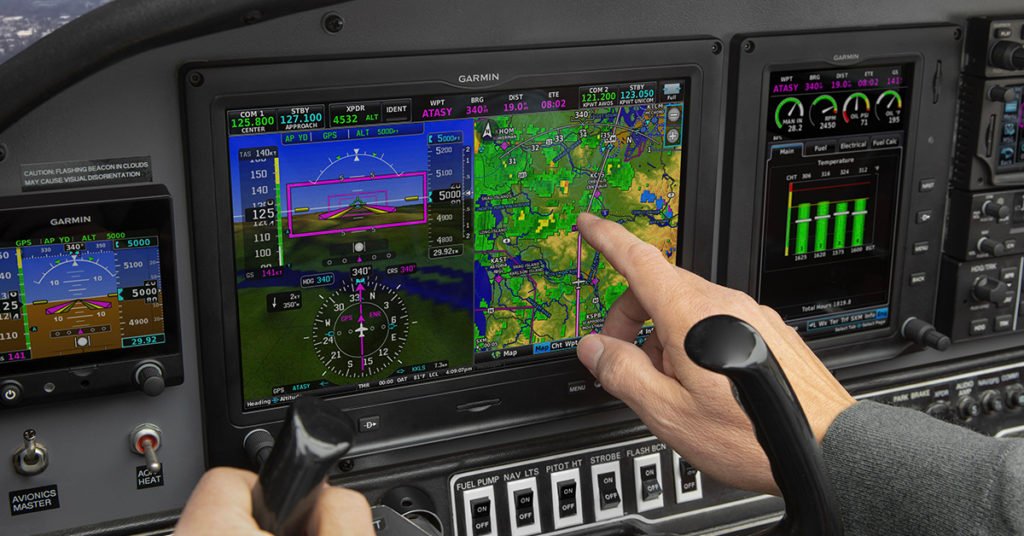
Garmin GPS Navigator Scenario-based Pilot Training Webinar (GPS 175, GNC® 355, GNX 375)
375)
Dec. 15, 2020, at 7 a.m. CST: Sign Up
Dec. 15, 2020, at 10 a.m. CST: Sign Up
Dec. 16, 2020, at 7 p.m. CST: Sign Up
Garmin GTN and TXi Scenario-based Pilot Training Webinar
Jan. 20, 2021, at 7 a.m. CST: Sign Up
Jan. 20, 2021, at 7 a.m. CST: Sign Up
Jan. 21, 2021, at 7 a.m. CST: Sign Up
Garmin GNS Scenario-based Pilot Training Webinar – Part I
Feb. 15, 2021, at 7 a.m. CST: Sign Up
Feb. 15, 2021, at 10 a.m. CST: Sign Up
Feb. 16, 2021, at 7 p.m. CST: Sign Up
Garmin GNS Scenario-based Pilot Training Webinar – Part II
March 16, 2021, at 7 a.m. CDT: Sign Up
March 16, 2021, at 10 a.m. CDT: Sign Up
March 17, 2021, at 7 p.m. CDT: Sign Up
Garmin Accident Mitigation Pilot Training Webinar
Join us as we explore and discuss accidents in aviation history and how we can use Garmin avionics — including GTN series navigators — to help mitigate and alleviate those safety concerns in our everyday flying.
April 21, 2021, at 7 a.m. CDT: Sign Up
April 22, 2021, at 10 a.m. CDT: Sign Up
April 22, 2021, at 7 p.m. CDT: Sign Up
Garmin Presents: Cirrus Perspective+ Scenario-based Pilot Training Webinar
May 12, 2021, at 7 a.m. CDT: Sign Up
May 13, 2021, at 7 a.m. CDT: Sign Up
May 13, 2021, at 10 a.m. CDT: Sign Up
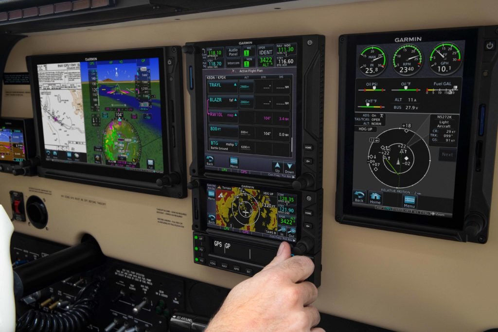
Garmin GTN Mini-scenarios – Pilot Training Webinar
Have a specific scenario you would like the training team to talk about? These webinars are your chance! Our team will be taking select scenarios, as requested by you, and have in-depth discussions on how best to accomplish the scenarios with Garmin avionics.
June 16, 2021, at 7 a.m. CDT: Sign Up
June 16, 2021, at 10 a.m. CDT: Sign Up
June 17, 2021, at 7 p.m. CDT: Sign Up
We also offer a limited number of computer (PC) and iPad trainers as a convenient way to learn the basic operation of select Garmin avionics. These trainers simulate the behavior of an avionics system interface — such as GTN, GTN Xi and TXi series products — and can be downloaded at www.Garmin.com or the Apple App Store. For all of your aviation training needs, please visit fly.garmin.com/fly-garmin/training/.
The post Garmin Aviation Training Team Adds Educational Webinars appeared first on Garmin Blog.
https://www.garmin.com/en-US/blog/aviation/garmin-aviation-training-team-adds-educational-webinars/
That radio interference might be coming from your cheap USB charger
In modern vehicles, people are more dependent than ever on the presence of a phone or tablet. Most new vehicles come with some sort of USB charging port that may even include USB communication to an in-vehicle infotainment system, allowing for streaming video, representation of CarPlay mapping on the vehicle display, etc. As consumers, we’re now accustomed to getting into a vehicle, plugging in our phone, and having that phone seamlessly connect and work with our vehicles.
But what if you don’t have a newer vehicle? What if your car, aircraft, RV, truck, or tractor was built before USB integration was a common customer expectation?
When shopping for a USB charging adapter you encounter a shockingly wide array of prices for such devices. Many options are available at discount stores or online for as little as $2.00.
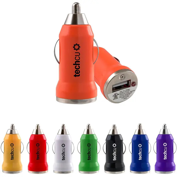

The Audi plug meets automotive standards. The other plugs do not.
That means that the Audi charger has been rigorously testing against standards from both regulators and the vehicle manufacturer themselves. The cheap adapters have an ambiguous level of testing and are self certified by the manufacturer (with no regulator or manufacturer oversight).
So what?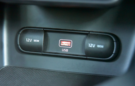 For automobiles in which USB charging ports are integrated by the manufacturer, they are tested against automotive standards. These standards ensure the devices are fit for the environment and will produce a high-quality customer experience. For example, it is inconceivable that plugging a phone or tablet into the manufacturer’s USB port would cause interface on AM, FM, or two-way radios. Plugging in a device and getting a bunch of static on the FM radio or completely losing two-way radio communication is intolerable.
This is, however, a common occurrence when using charging devices that are not designed for automotive use. A lot of these chargers carry FCC/CE marks, look safe and legit, but ultimately damage your ability to receive and transmit radio communications. This could be as benign as negatively impacting your ability to receive an AM radio station, or as painful and inconvenient as knocking out two-way radio communication completely — especially if that is your aircraft VHF comm.

What do I do about it?
Not all chargers are created equally. There are absolutely some high quality products available through online retailers that won’t cause radio noise. Unfortunately there’s really not much one can do to qualify such a charger when shopping, and the only practical way for pilots to sort through them is to buy them, put them in the aircraft, and see what happens. Many of these chargers will cause radio noise, and that noise will vary from slightly inconvenient to completely unmanageable.
Here are a couple of things to take into consideration when making that choice for your aircraft:
- USB charging technology changes VERY quickly. Just because you bought a charger from a specific brand and it worked, that does not mean that going back to the same supplier next time will provide a product that provides clean power without radio noise. This is because consumer devices are not governed by the same kind of engineering change control and certification practices as products that are regulated by folks like the FAA, or closely monitored by aircraft/vehicle OEMs with good design change control. A lot of consumer devices will roll fast with changes to new technology but repackage in the same tooling — therefore, buying what appears to be the same device might all of a sudden produce lots of interference.
- Vibration activity in aircraft and cars is very different. A lot of consumer-style USB chargers are generally designed in a manner that will be friendly for an on-road automotive experience. It’s a much different environment in the ‘74 PA-28 or M20B that you fly around on the weekends. Aircraft vibratory loads can be rough on devices that are not designed for them, so you might burn through cheaper chargers not designed for the environment rather quickly.
If you really need the radio, and to power a device in the aircraft during flight, you should make sure you can do both with a lot of confidence and use a manufacturer-provided solution (in a new aircraft or service part), or purchase a certified charger that you know is going to work and deliver a consistent experience if it is ever replaced.
Then you’ll absolutely have a charging solution that will allow you to aviate, navigate, and communicate without worrying about losing that last word along the way.
Video examples of radio interference
Check out this experiment after he experienced interference in his RV:
For a deeper dive, watch this video from Kenwood (a radio company). They produced a demonstration with a two-way radio, which is a low-frequency radio (typically between 151 and 154 MHz) that operates in bands similar to those used in aircraft.
 David Batcheller – President & CBO
https://www.appareo.com/2020/10/12/that-radio-interference-might-be-coming-from-your-cheap-usb-charger/
What’s the difference between SIM and eSIM?
Connectivity technologies are confusing for people, and the industry is loaded with perplexing acronyms and buzzwords.
One of the most recent areas commonly fostering misconceptions is the difference between SIMs and eSIMs. This article is going to break it down in way that will hopefully help to inform your connectivity conversations.
Understanding SIMs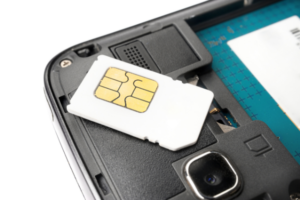 The abbreviation SIM means “Subscriber Identity Module” and the devices were originally created to identify which subscriber is associated with a phone. Most people have a specific physical impression of a SIM, which is a little plastic card that we slide into a phone. In fact, there are a number of different physical manifestations of what you would know as a SIM card.
The industry has different media on which a subscriber for a device can be identified. In general, manufacturers of rugged connectivity equipment strongly prefer and heavily leverage the MFF2 (M2M form factor). This is also sometimes referred to as a Machine Identification Module, or “MIM.” The reason manufacturers prefer these MFF2 units is because the vibratory specifications for aircraft and off-highway equipment are very unfriendly to SIM cards like the 3FF. During rigorous vibration tests, the shaking of the SIM card against its cage (which creates a phenomenon called fretting corrosion) wears through the very thin metal deposited on the plastic and destroys the card, resulting in the cellular function to stop working. Not cool.
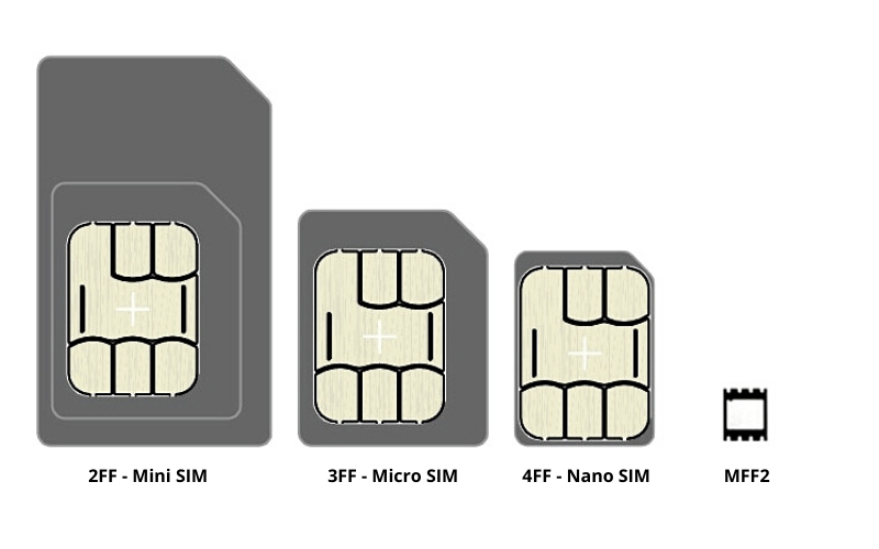
eSIM vs SIM
Regardless of whether or not you have a 2FF, 3FF, 4FF, or MFF2 SIM/MIM, that hardware is really just a carrier for the UICC (universal integrated circuit card). This UICC is a read-only network profile. In other words, the device manufacturer will get a pile of chips (in any of the hardware manifestations shown above) that are pre-loaded with keys that cannot be changed during, or after, device manufacture.
Recently, it has become possible to purchase hardware that contains an eUICC (embedded universal integrated circuit card). This change means that instead of having a read-only network key on the SIM/MIMs that the manufacturers receive, this hardware can now be programmable and can host keys from multiple carriers on a single SIM/MIM. Some people initially think “great, I can tell AT&T to get lost and just program my unit over the air to work on Verizon whenever I want.” Unfortunately that isn’t true. Although that would be a great capability and introduce helpful flexibility for a lot of customers in many applications, you simply cannot do that today with an eUICC.
However, this is still really cool for manufacturers.
Here is why you should be excited about eSIM capabilities. Device manufacturers will often work with a carrier partner (e.g. AT&T, KPN, Rodgers, T-Mobile, Verizon, Vodafone, etc.) to certify a device with a specific carrier. Then, behind that carrier are dozens of local networks that will support these devices.
What the eSIM allows people to do is have multiple network profiles for local carriers on a single product, and update those over the air. When a vehicle travels from geography to another while using the same carrier, your device manufacturer can update the device to provision it for the local network, without changing a SIM. This is really powerful for getting products into geographies where cellular plan and regulatory constraints have historically driven a multitude of additional device SKUs and given manufacturers significant headaches managing equipment export — or equipment travel from one geography from another.
Some examples:


For equipment manufacturers, eSIMs are going to be a powerful tool for simplifying connectivity of a fleet while minimizing the burden on the manufacturer and reducing the number of device SKUs required to achieve truly global connectivity.
 David Batcheller – President & CBO
https://www.appareo.com/2020/10/08/whats-the-difference-between-sim-and-esim/
Understanding IP Ratings for Rugged Electronics
For many years, electronics manufacturers have utilized environmental testing to simulate years of product use in the field. As products fail, teams of engineers have dug into each of these failures to understand them, build better tests to simulate the conditions that created them, and use those tests in design validation to ensure that such failures don’t occur in the field again. In general, environmental tests include a broad spectrum of different challenges to ensure a robust design.
Some common tests are:
- Power input – trying to damage the product by simulating bad power connections or incorrect power supply
- Transit shock – trying to introduce damage from mishandling during shipping
- Particle impact – trying to damage the product due to particles thrown by tires, air blasts, etc.
- Electrostatic discharge – trying to electrically shock the product and damage it
- Chemical resistance – trying to damage the product by exposure to hazardous chemicals potentially occurring in the operating environment
- Ultraviolet effects – trying to damage the product through environmental exposure to light
- Temperature & humidity testing – cycling the product through many cycles of high temperature, humidity, and low temperature to simulate many seasons of outdoor exposure
- Thermal shock – trying to damage the product through temperature shock
- Vibration and shock testing – trying to shake and shock the product into a damaged state
These tests are described by a series of industry standards and tests. One of the most common ratings for environmental suitability seen today in product specifications and datasheets is the IP rating.
What is the “IP Rating”?
In this context IP stands for International Protection Rating, but is often read as Ingress Protection. Looking at this rating provides a more nuanced and descriptive articulation of product capabilities than “water resistant” or “dustproof.” These ratings are described in standards like IEC 60529, DIN 40050-9, and ISO 20563 (which replaced DIN 40050-9). Testing against these ratings produces IP ratings like IP44, IPX5, IP5X, IP65/67, etc.
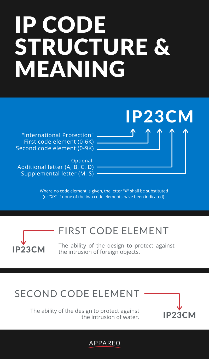
What does the first number mean?
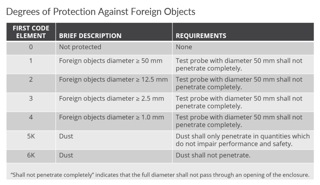
The first number is associated with the ability of the design to protect against the intrusion of foreign objects that could cause damage to the device or cease its function. The higher the number, the smaller the particle necessary to get inside the device.
Below is an example of the 6K variety of the ISO 20653 test. In this test, to ensure dust will not penetrate the enclosure design, a vacuum is pulled on the device to ensure that it is dust tight. You can see that the enclosure is entirely caked in fine dust after the test.
What does the second number mean?
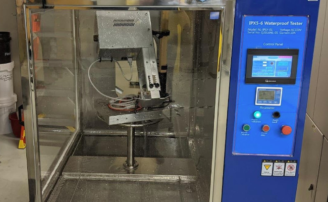 The second number is associated with the ability of the design to protect against intrusion of water. The higher the number, the more sealed the device against intrusion of water. When higher numbers are reached, however, there is some nuance as to the method of testing that becomes important. For example, IP69 is not necessarily better sealed than IP67 — they are both very well sealed, just tested against different areas of concern.
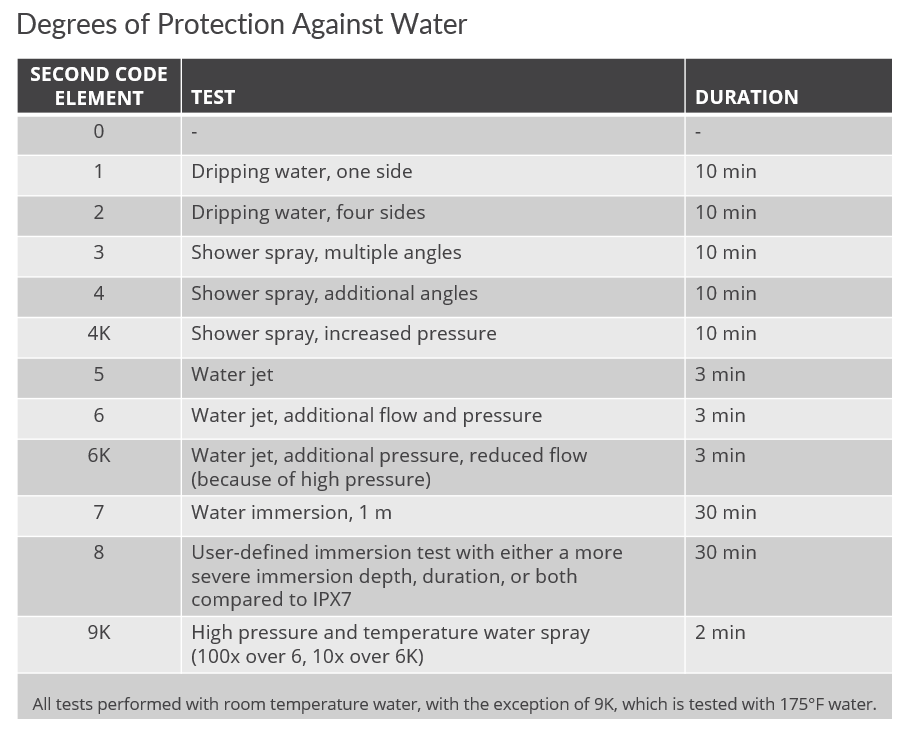
What about other ratings?
Manufacturers only publicly rate devices to what they have actually tested against. For example, a device might be tested against IP69K and be totally suited for use in an IP67 environment, but the manufacturer’s initial customer didn’t require the IP67 test, so it was never run. Vice versa, sometimes designs are capable of qualifying and passing higher levels of ingress certification than publicly rated for — especially as it pertains to the difference between IP67 and IP69K.
If you see an ingress certification rating for a device that does not meet your specification as an equipment manufacturer, don’t be afraid to ask your device manufacturer about the device’s suitability for a similar rating.
 Nathan Schneck – Director, Test & Certification
https://www.appareo.com/2020/10/06/understanding-ip-ratings-for-rugged-electronics/
D2 Air: Aviator Smartwatch with Powerful Flight Functionality, Vibrant AMOLED Display
Introducing D2 Air, our latest GPS smartwatch for the modern pilot with powerful aviation capabilities and a sleek, new touchscreen design that can be worn 24/7. The newest addition in the D2 aviator watch series, the D2 Air offers tools for all phases of flight, including weather, direct-to navigation, airport information, flight logging, Pulse Ox1, and much more. To keep up with life on the go, the D2 Air incorporates connected features like smart notifications2, Garmin Pay contactless payment solution3 and phone-free music, along with enhanced health monitoring, and animated workouts.
“The D2 Air is an exciting option for current and aspiring pilots, as well as the aviation enthusiast,” said Carl Wolf, vice president of aviation sales and marketing. “The D2 Air offers a bright and striking display with valuable capabilities that benefit pilots in the air while offering advanced smartwatch features on the ground, placing the D2 Air aviator smartwatch in a category of its own.”
A Dedicated In-Flight Navigator on Your Wrist
The D2 Air includes several pre-flight features and tools, with the ability to display multiple time zones including Zulu time, and METAR and TAF aviation weather reports and forecasts, to name a few. Additionally, airport information such as runway orientation with wind components, runway lengths, airport frequencies and traffic pattern altitudes are easily accessible for each airport.
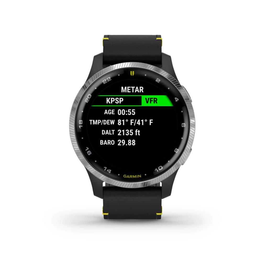
Preloaded with a worldwide navigation database containing NAVAIDs and Intersections, a waypoint info page, direct-to navigation, a three-axis compass with a horizontal situation indicator (HSI), and an altimeter with adjustable barometric setting, the D2 Air is packed with features to assist aviators in navigation and enhance situational awareness.
The D2 Air utilizes Garmin Pilot flight plan transfer4, allowing for an easy way to access to flight plan information by seamlessly transferring flight plans into the watch. Aviation alerts such as speed, time, distance, elevation, and a fuel timer are available on the D2 Air watch during flight. For post-flight ease, the D2 Air integrates with flyGarmin.com logbook5 to sync post-flight data such as date, duration, and route of flight.
Smart Features for Life on the Go
The D2 Air provides all-day connection and convenience for life on the go. When paired with a compatible device, users can receive smart notifications for incoming calls, text messages, calendar reminders and more on the vivid 1.2” AMOLED touchscreen display. Users can also download songs or playlists6, including those from third-party music services like Spotify, Amazon Music and Deezer6. And with Garmin Pay, pilots can make contactless payments right from their wrist3.
Health, Wellness and Sports
As a multifunctional smartwatch, the D2 Air offers a broad range of health and wellness features, including advanced sleep monitoring, respiration tracking, stress tracking, hydration tracking, the Body Battery energy monitor enabling pilots to track energy levels all-day, Pulse Ox that gauges blood oxygen saturation levels for reference when flying at altitude, and more1. With GPS, Elevate wrist-based heart rate7, and over 20 built-in indoor and outdoor sports apps including walking, running, cycling, pool swimming, golf and more, the D2 Air is packed with features to keep up with an active lifestyle.
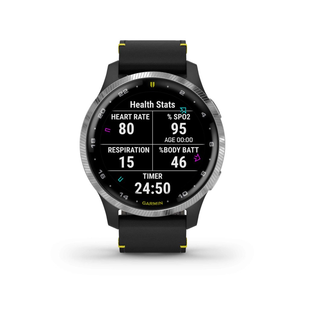
The D2 Air’s AMOLED screen brings workouts to life with an additional 40+ on-device animated workouts for strength training, cardio, yoga and Pilates. Easy-to-follow workouts demonstrate proper form and technique right on the user’s wrist and can be downloaded at no charge from the Garmin Connect app5.
Designed for Flying in Style
The design of the D2 Air features an aviation-themed watch face, stylish stainless-steel finish on a 43.2mm bezel and an elegant premium black leather strap with yellow accents. The D2 Air boasts a rugged scratch- and damage-resistant lens with Corning® Gorilla® Glass 3 for durability, allowing pilots the freedom to use the watch as it was designed in a demanding flight environment. Also included with the D2 Air is a sporty silicone quick-release watch band, allowing for a seamless transition between exercise or a round of golf, to a more formal leather strap better suited for business environments or a night out, with additional band options available and sold separately.
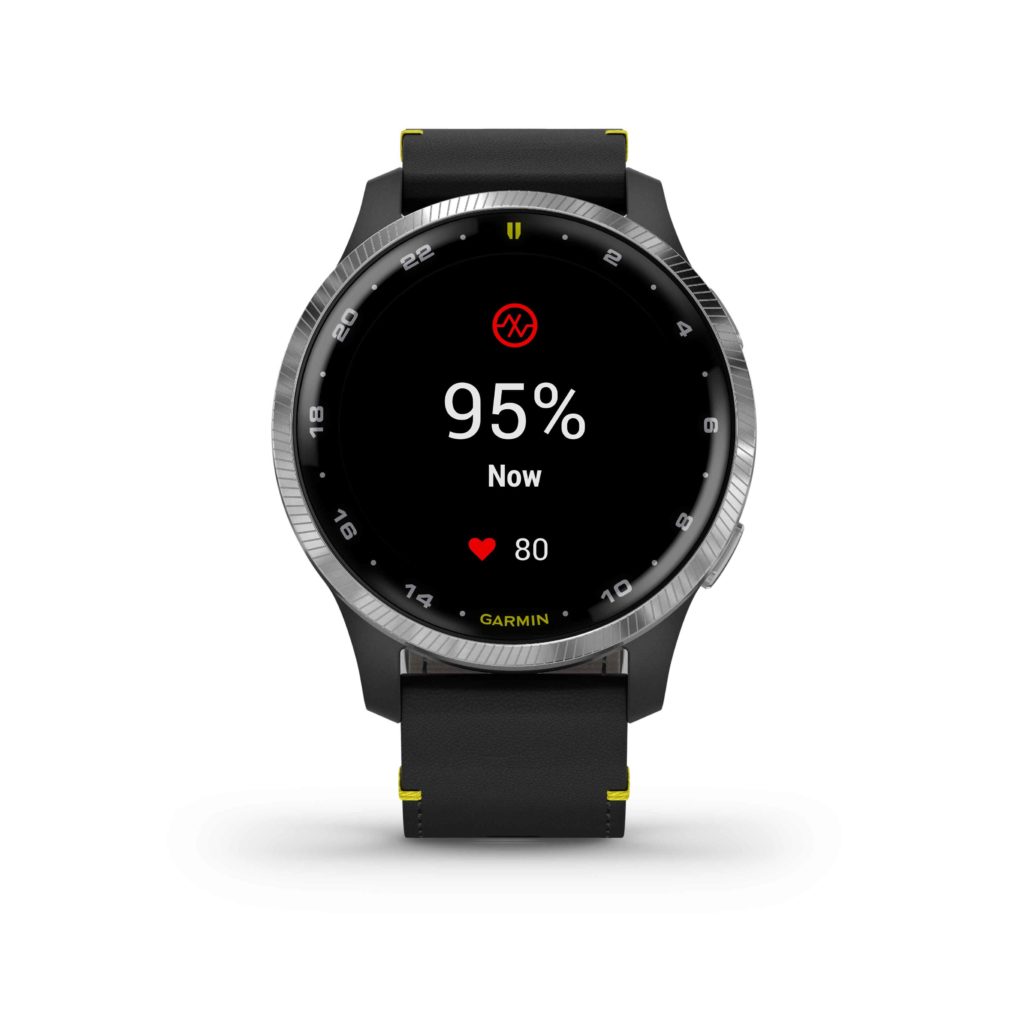
The D2 Air boasts a battery life of up to 5 days while using smart notifications and pre-flight planning tools, and up to 10 hours of battery life when continuously using GPS and Pulse Ox while flying. Pilots can utilize the D2 Air’s always-on mode to ensure all their information is right at hand when they need it. The D2 Air is available now for a suggested retail price of $499.
1 This is not a medical device and is not intended for use in the diagnosis or monitoring of any medical condition; see Garmin.com/ataccuracy. Pulse Ox not available in all countries.
2 When paired with a compatible smartphone; see Garmin.com/ble
3 View current supported country, payment network and issuing bank information at Garmin.com/GarminPay/banks
4 When paired with a compatible smart device downloaded with the Garmin Pilot app
5 When paired with a compatible smart device downloaded with the Garmin Connect app
6 May require premium subscription by a third-party music provider
7 See Garmin.com/ataccuracy
The post D2 Air: Aviator Smartwatch with Powerful Flight Functionality, Vibrant AMOLED Display appeared first on Garmin Blog.
https://www.garmin.com/en-US/blog/aviation/d2-air-aviator-smartwatch-with-powerful-flight-functionality-vibrant-amoled-display/
GTN to GTN Xi Upgrade — Keeping It Simple
Our latest GTN Xi series navigators offer numerous benefits over earlier GTN
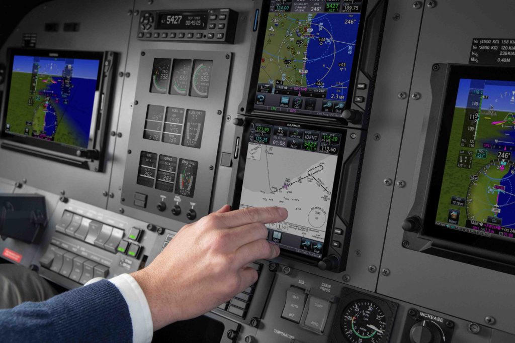
 models. Some of the operational advantages include a touchscreen display that is brighter and sharper, and faster processing speeds that make performance a breeze. But one of greatest benefits comes before any flight takes place. Designed as direct, slide-in upgrade for its predecessor, GTN Xi can replace existing GTN units utilizing the same mounting hardware, helping to eliminate costly and intrusive panel modifications, as well as unnecessary aircraft downtime.
A slide-in, pin-for-pin replacement
By maintaining the same avionics rack and connectors, our engineering team designed the GTN Xi series to fit existing GTN 750/650 series installation racks; no expensive panel modifications required. In most cases, this upgrade can be completed in as little as a few hours at an authorized Garmin dealer. Compatibility and simplicity encourage lower installation costs and aircraft downtime so aircraft can return to service more quickly.
Faster processing, higher-resolution display
Powerful dual-core processers within GTN Xi cut boot-up speeds by 50% over earlier GTN models, so pilots can load flight plans and tune frequencies more quickly. Additionally, the graphical display capabilities within the GTN Xi units have been enhanced to provide faster zooming, panning and map rendering on the touchscreen display. The touchscreen display has nearly double the pixel count of older GTN displays, offering even wider viewing angles and clarity. Valuable information such as charts, approach plates and maps load faster and in sharper resolution.
Broad avionics compatibility
Like its predecessor, the GTN Xi series was designed to interface with wide range of existing avionics, autopilots and flight displays. Aircraft owners and operators can benefit from the ability of GTN Xi to fit a variety of avionics configurations. With so many unique panels and avionics combinations in the field, GTN Xi was created with system compatibility in mind.
For more information about our GTN Xi series avionics, visit Garmin.com/Aviation.
The post GTN to GTN Xi Upgrade — Keeping It Simple appeared first on Garmin Blog.
https://www.garmin.com/en-US/blog/aviation/gtn-to-gtn-xi-upgrade-keeping-it-simple/

